

Schönbachweg up to the Gahberg


- pets allowed
- All weather
- Suitable for families
Interactive elevation profile
Create PDF
Tour-Details
Paths covering:
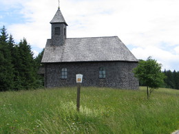
With a view of the lake in the Salzkammergut mountains in Upper Austria: a leisurely hike leads from Schörfling am Attersee along the Schönbachweg, a well-maintained forest path that winds through the wooded hills west of the lake, to the Gahberg, which offers a magnificent view of Lake Attersee.
The starting point of the hike is the former Freund department store in Oberhehenfeld.
From there you continue towards Gahberg, which is to the west. From there it is now not far until you reach the Gahberg. There you will be rewarded with a magnificent view of the Attersee. After an extensive break, you hike back to the starting point on the same path.
If you want to go a little further, you can walk back to Oberhehenfeld via the 715 m high Häfelberg.
There are no refreshment stops along the way, but in the village of Schörfling a wide range of restaurants surrounds you after the hike.
further information:
- Board possible
by car:
From Salzburg via the A1 - Seewalchen exit
From Vienna/Linz via the A1 - exit Schörfling or Seewalchen
From the west - Bad Ischl-Weißenbach-Steinbach-Weyregg-Schörfling
by train:
Coming from Salzburg or Linz/Vienna to Attnang-Puchheim or Vöcklabruck - continue with the Kammer Bahn to BH Kammer Schörfling or with the bus stop Kammer-Agerbrücke or Seewalchen-Agerbrücke.
Parking possibilities:
- former department store Freund in Oberhehenfeld, Sickingerstraße 52
- Parking space: 10
- All weather
- Suitable for groups
- Suitable for schools
- Suitable for kids (6 - 14 Year)
- Pets allowed
- Suitable for teenagers
- Suitable for seniors
- Suitable for single travelers
- Suitable for families
- Suitable for friends
- Suitable for couples
- Suitable for children
- Spring
- Summer
- Autumn
Not suitable for wheelchairs. The property is not compliant with Austria's ÖNORM legal standard.
")
Dorfstraße 33
4865 Nußdorf am Attersee
Phone +43 7666 7719 - 0
E-Mail info.schoerfling@attersee.at
Web attersee-attergau.salzkammergut.at
You can also visit us on
Visit us on Facebook Visit our videochannel on YouTube WikipediaInteractive elevation profile
Create PDF
Tour-Details
Paths covering: