

Entlang der Ischler Ache


- Suitable for families
- Suitable for kids (all ages)
- Flatly
Interactive elevation profile
Create PDF
Tour-Details
Paths covering:
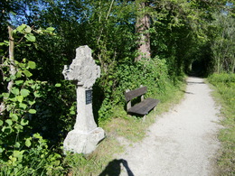
A flat run on a picturesque walking trail.
Start at the lake water outlet sluice. Go right along the Ischler Ache (river) on the footpath to the Schlagermühle (farmstead). Left over the bridge and immediately right onto the track to the main road. Go right and a little downhill, then along the left Ischler Ache (riverbank) to the bridge in Aigen-Voglhub. Go over the bridge and then right on the Bachweg (path) to the road. 400mt along the road go right to the Ischler Ache (river) again and keep going until you come to the road. Continue on the road and then over the Weißenbach bridge. Turn right upstream to the Römerweg (path) to where the path branches. Take the left branch to ….., then to Seethurn (guesthouse), downhill to Wirerstraße (road) back to the sluice.Distance: 9,6 km
Elevation difference: 40 m
Gravel-Course: 8 km
Tarmac-Course: 1,6 km
Time: 30 to 58 min
Nordic Walking: 115 min
further information:
- Flatly

Direction information: straight ahead

Direction information: straight ahead

Direction information: straight ahead
Direction information: straight ahead

Direction information: straight ahead

Direction information: straight ahead
Direction information: straight ahead

Direction information: straight ahead

Direction information: straight ahead
Direction information: straight ahead

Direction information: straight ahead

Direction information: right
Entry to the Achenweg is possible.

Direction information: straight ahead
Direction information: straight ahead

Direction information: straight ahead

Direction information: right

Direction information: left

Direction information: right

Direction information: right

Direction information: straight ahead

Direction information: straight ahead
Direction information: straight ahead

Direction information: straight ahead

Direction information: straight ahead

Direction information: right

Direction information: straight ahead

Direction information: straight ahead

Direction information: straight ahead
Direction information: straight ahead
Direction information: straight ahead
Direction information: straight ahead

Direction information: right

Direction information: left

Direction information: straight ahead

Direction information: left

Direction information: right
Direction information: right
The walk starts in the center of Strobl, directly at the village square.
Parking- Parking space: 25
- Suitable for groups
- Suitable for schools
- Suitable for kids (3 - 6 Year)
- Suitable for kids (all ages)
- Suitable for families
- Spring
- Summer
- Autumn
Please get in touch for more information.
Au 140
5360 St. Wolfgang im Salzkammergut
Phone +43 6138 8003
E-Mail info@wolfgangsee.at
Web www.wolfgangsee.at
Interactive elevation profile
Create PDF
Tour-Details
Paths covering: