© Photo: Oberösterreich Tourismus GmbH./Robert Maybach: Enjoy the view in Upper Austria


Maria-Bründl-Weg


- Suitable for families
Interactive elevation profile
Create PDF
Tour-Details
Starting place: 4760 Raab
Destination: 4760 Raab
duration: 0h 57m
length: 3,6 km
Altitude difference (uphill): 44m
Altitude difference (downhill): 41m
Lowest point: 370m
Highest point: 397m
difficulty: very easy
condition: very easy
panoramic view: Individual Views
Paths covering:
Asphalt, Hiking trail
powered by TOURDATA
Description:
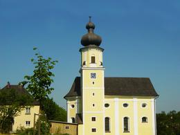
Starting at the school centre, the trail leads to Moarhof and from there continues along the Bründlbach stream. Continue through the loops towards Pfarrerholz and via Steinbruck past the fire station to finally reach the Chapel of Grace in Maria Bründl with its healing spring. Descend the Ameisleiten and follow the Bründlbach stream back to the starting point.
According to tradition, the healing power of the spring was recognised when the maid of a Lebzelter, who had bathed her sick feet in the forest spring, was cured. Today, the spring water is also very popular as drinking water.
- Suitable for groups
- Suitable for schools
- Suitable for teenagers
- Suitable for seniors
- Suitable for single travelers
- Suitable for families
- Suitable for friends
- Suitable for couples
- Suitable for children
- Spring
- Summer
- Autumn
- Early winter
- Deep winter
Please get in touch for more information.
Marktstraße 7
4760 Raab
Phone +43 7762 2255
E-Mail gemeinde@raab.ooe.gv.at
Web www.raab.ooe.gv.at/system/web/sonde…
http://www.raab.ooe.gv.at/system/web/sonderseite.aspx?menuonr=219567021&detailonr=219567021
Interactive elevation profile
Create PDF
Tour-Details
Starting place: 4760 Raab
Destination: 4760 Raab
duration: 0h 57m
length: 3,6 km
Altitude difference (uphill): 44m
Altitude difference (downhill): 41m
Lowest point: 370m
Highest point: 397m
difficulty: very easy
condition: very easy
panoramic view: Individual Views
Paths covering:
Asphalt, Hiking trail
powered by TOURDATA