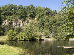
© Photo: Oberösterreich Tourismus GmbH./Robert Maybach: Enjoy the view in Upper Austria


Granitweg


Interactive elevation profile
Create PDF
Tour-Details
Starting place: 4760 Raab
Destination: 4760 Raab
duration: 2h 19m
length: 8,6 km
Altitude difference (uphill): 116m
Altitude difference (downhill): 113m
Lowest point: 366m
Highest point: 422m
difficulty: very easy
condition: very easy
panoramic view: Individual Views
Paths covering:
Asphalt, Hiking trail
powered by TOURDATA
Route:
Raab - Maria Bründl - Riedlhof - Thal - Straßwitraun - Weeg - Raab
Description:
The trail starts at the school centre, runs from there to Moarhof and along the Bründlbach stream and over the Ameisleiten to Maria Bründl. Passing the miller in Bründl, you reach the Red Cross via Riedlhof.
The foothills of the granite highlands with the Sauwald forest made granite mining possible in the area. The trail continues to Thal, Straßwitraun, Weeg, via Pfarrerholz and Moarhof back to the starting point.
Most economical season
- Spring
- Summer
- Autumn
- Early winter
- Deep winter
Please get in touch for more information.
Marktstraße 7
4760 Raab
Phone +43 7762 2255
E-Mail gemeinde@raab.ooe.gv.at
Web www.raab.ooe.gv.at/system/web/sonde…
http://www.raab.ooe.gv.at/system/web/sonderseite.aspx?menuonr=219567021&detailonr=219567021
Interactive elevation profile
Create PDF
Tour-Details
Starting place: 4760 Raab
Destination: 4760 Raab
duration: 2h 19m
length: 8,6 km
Altitude difference (uphill): 116m
Altitude difference (downhill): 113m
Lowest point: 366m
Highest point: 422m
difficulty: very easy
condition: very easy
panoramic view: Individual Views
Paths covering:
Asphalt, Hiking trail
powered by TOURDATA