© Photo: Oberösterreich Tourismus GmbH./Robert Maybach: Enjoy the view in Upper Austria


Pöttinger Rundwanderweg


Interactive elevation profile
Create PDF
Tour-Details
Starting place: 4720 Pötting
Destination: 4720 Pötting
duration: 2h 12m
length: 8,1 km
Altitude difference (uphill): 56m
Altitude difference (downhill): 53m
Lowest point: 371m
Highest point: 424m
difficulty: very easy
condition: very easy
panoramic view: Individual Views
Paths covering:
Hiking trail
powered by TOURDATA
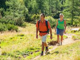
Starting point: Pötting town square. The Pöttinger hiking trail takes you to the south-eastern tip of the Hausruck Nord region. It leads through the village to Prambeckenhof and turns south towards Spielmannsberg. A quiet country road winds its way through Kronlach, where a farmer offers pasta specialities from his own production. In Obernfürth, on the other hand, a longer stay may be necessary, as it may take a while to taste your way through the wide range of schnapps specialities on offer at the Lohetsbergerhof farm.
Further information on the circular hiking trail can be obtained from the municipal office.
Further information on the circular hiking trail can be obtained from the municipal office.
Most economical season
- Spring
- Summer
- Autumn
Please get in touch for more information.
4720 Pötting
Phone +43 7733 7285
Fax machine +43 7733 7285 - 18
E-Mail gemeinde@poetting.ooe.gv.at
Web www.poetting.ooe.gv.at/
http://www.poetting.ooe.gv.at/
Interactive elevation profile
Create PDF
Tour-Details
Starting place: 4720 Pötting
Destination: 4720 Pötting
duration: 2h 12m
length: 8,1 km
Altitude difference (uphill): 56m
Altitude difference (downhill): 53m
Lowest point: 371m
Highest point: 424m
difficulty: very easy
condition: very easy
panoramic view: Individual Views
Paths covering:
Hiking trail
powered by TOURDATA