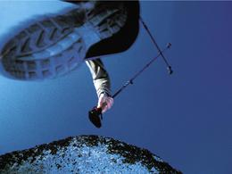
© Photo: Oberösterreich Tourismus GmbH./Robert Maybach: Enjoy the view in Upper Austria
Stecka-Streck'n


- Flatly
Interactive elevation profile
Create PDF
Tour-Details
Starting place: 4722 Peuerbach
Destination: 4722 Peuerbach
duration: 1h 30m
length: 12,3 km
Altitude difference (uphill): 332m
Altitude difference (downhill): 332m
Lowest point: 365m
Highest point: 511m
difficulty: medium
condition: medium
panoramic view: Some Views
Paths covering:
Asphalt, Hiking trail
powered by TOURDATA
The "Stecka-Streck'n" has been specially designed to meet the needs of Nordic walkers and shows the most scenic features of Peuerbach and the surrounding area. The route is shown on the town and hiking map of Peuerbach (available free of charge from the town council or the tourist office). It can also be found on the town's homepage and in the book "33 paths for body and soul".
Book price: € 14.90. Orders can be placed at the Peuerbach town office on 07276/2255-18 or by e-mail to stadt@peuerbach.ooe.gv.at or at walkingbuch@nachrichten.at.
Route: From the historic town centre up to the sweeping view of the Landl, down to the unspoilt nature reserve "Koaserin" and through the romantic Leithental, across meadows, through forests, up hills and through valleys back to the town of stars with its highlights worth seeing. Starting point and destination: Peuerbach Castle. From Peuerbach Castle, the trail leads past the parish church, the Urtlhof inn and the Urtl "Der Gebückte". Take your time and discover the origins of these springs. Follow the one-way street for approx. 50 metres and then turn right and follow hiking trail no. 2 into the Leithental valley. At the "Lindner Chapel" you have a wonderful view of the Landl. From here, continue left down to the "Koaserin" nature reserve. At the nature experience island, you can find out about the impressive flora and fauna. The route continues deeper into the Leithental valley. After crossing the bridge, follow the signs for Almweg on the left. From now on it's uphill to Eichelberg, past the Wenzl-Gut. Enjoy the view of the region again here. Continue through the forest, where you have a very good view over the entire valley at the "Leithentalblick". Before descending again along the Mühlweg, you have the opportunity to visit the "Timewalk" and follow in the footsteps of our ancestors. Once you reach the crossroads in the forest, follow the Mühlweg to the right and take a break at Ludwig's Rastplatzl. Follow Leithenbachstraße for approx. 200 metres to the left, then take the next ascent to the right through the forest. Continue to follow the markings. Continue through the village of Spielmannsberg to the Reiterstüberl. A refreshment stop is worthwhile. Keep right and follow the road straight ahead. Approx. 50 metres after the bend to the right, turn left into the meadow path. Back on the road, turn left again and you will come straight back to the town centre.
Most economical season
- Spring
- Summer
- Autumn
Please get in touch for more information.
4722 Peuerbach
Phone +43 7276 2255 - 18
Fax machine +43 7276 2255 - 20
E-Mail stadt@peuerbach.ooe.gv.at
Web www.peuerbach.at
https://www.peuerbach.at
Interactive elevation profile
Create PDF
Tour-Details
Starting place: 4722 Peuerbach
Destination: 4722 Peuerbach
duration: 1h 30m
length: 12,3 km
Altitude difference (uphill): 332m
Altitude difference (downhill): 332m
Lowest point: 365m
Highest point: 511m
difficulty: medium
condition: medium
panoramic view: Some Views
Paths covering:
Asphalt, Hiking trail
powered by TOURDATA
