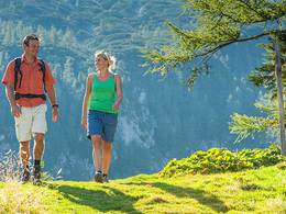
© Photo: Oberösterreich Tourismus GmbH./Robert Maybach: Enjoy the view in Upper Austria


Pramweg


Interactive elevation profile
Create PDF
Tour-Details
Starting place: 4775 Taufkirchen an der Pram
Destination: 4775 Taufkirchen an der Pram
duration: 1h 21m
length: 6,0 km
Altitude difference (uphill): 16m
Altitude difference (downhill): 9m
Lowest point: 324m
Highest point: 345m
difficulty: easy
condition: easy
panoramic view: Individual Views
Paths covering:
Asphalt, Gravel
powered by TOURDATA
Route:
Taufkirchen an der Pram - Pramsteg - Igling - Kapelln - Wimm - Taufkirchen an der Pram
Description:
The Pramweg has a length of 4.3 km and starts at the town square of Taufkirchen an der Pram. The trail leads over the Pramsteg, along the Pram to the confluence of the Pramauerbach stream, past the natural monument (a 1700-year-old bog oak). Continue to Igling, Kapelln and Wimm, back to Taufkirchen an der Pram.
Most economical season
- Spring
- Summer
- Autumn
Please get in touch for more information.
Schärdinger Straße 1
4775 Taufkirchen an der Pram
Phone +43 7719 7255
Fax machine +43 7719 7255 - 30
E-Mail gemeinde@taufkirchen-pram.ooe.gv.at
Web www.taufkirchen-pram.at
http://www.taufkirchen-pram.at
Interactive elevation profile
Create PDF
Tour-Details
Starting place: 4775 Taufkirchen an der Pram
Destination: 4775 Taufkirchen an der Pram
duration: 1h 21m
length: 6,0 km
Altitude difference (uphill): 16m
Altitude difference (downhill): 9m
Lowest point: 324m
Highest point: 345m
difficulty: easy
condition: easy
panoramic view: Individual Views
Paths covering:
Asphalt, Gravel
powered by TOURDATA