© Photo: Oberösterreich Tourismus GmbH./Robert Maybach: Enjoy the view in Upper Austria


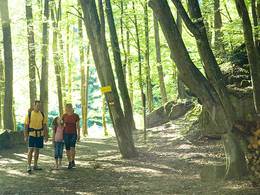
Kirchensteig Höbmannsbach


Interactive elevation profile
Create PDF
Tour-Details
Starting place: 4775 Taufkirchen an der Pram
Destination: 4775 Taufkirchen an der Pram
duration: 1h 6m
length: 4,2 km
Altitude difference (uphill): 54m
Altitude difference (downhill): 37m
Lowest point: 336m
Highest point: 380m
difficulty: easy
condition: easy
panoramic view: Some Views
Paths covering:
Asphalt
powered by TOURDATA
Route:
Taufkirchen an der Pram - Berndobler Straße - Höbmannsdorf - Höbmannsbach
Description:
The Kirchensteig Höbmannsbach has a length of 3.5 km and starts at the town square of Taufkirchen an der Pram. The trail leads along Berndobler Straße via "Rader" to Höbmannsdorf and Höbmannsbach to the village chapel. It is possible to return to Taufkirchen an der Pram via the Marterlweg and Kapellenweg paths. In this case, the route is 10.5 kilometres long.
Most economical season
- Spring
- Summer
- Autumn
Please get in touch for more information.
Schärdinger Straße 1
4775 Taufkirchen an der Pram
Phone +43 7719 7255
Fax machine +43 7719 7255 - 30
E-Mail gemeinde@taufkirchen-pram.ooe.gv.at
Web www.taufkirchen-pram.at
http://www.taufkirchen-pram.at
Interactive elevation profile
Create PDF
Tour-Details
Starting place: 4775 Taufkirchen an der Pram
Destination: 4775 Taufkirchen an der Pram
duration: 1h 6m
length: 4,2 km
Altitude difference (uphill): 54m
Altitude difference (downhill): 37m
Lowest point: 336m
Highest point: 380m
difficulty: easy
condition: easy
panoramic view: Some Views
Paths covering:
Asphalt
powered by TOURDATA