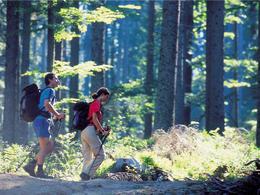
© Photo: Oberösterreich Tourismus GmbH./Robert Maybach: Enjoy the view in Upper Austria


WILDENAUER-WEG | Bewegungs-Arena INNVIERTEL


- All weather
- Suitable for families
- Suitable for pushchairs
- Flatly
Interactive elevation profile
Create PDF
Tour-Details
Starting place: 5252 Aspach
Destination: 5252 Aspach
duration: 1h 54m
length: 7,5 km
Altitude difference (uphill): 54m
Altitude difference (downhill): 50m
Lowest point: 408m
Highest point: 453m
difficulty: medium
condition: medium
panoramic view: Some Views
Paths covering:
Asphalt, Hiking trail
powered by TOURDATA
From the Kneipp spa house to the main road - there turn right to the main school - sundial with stone benches - left - follow the Buchleiting estate road - Buchleiting village - Eisecking village (Deubler chapel) - turn right onto the St.Veit/Wildenau road - Wildenau (former Ahamer moated castle) - castle chapel
Return to Aspach via the old municipal road or the bypass road (past the bathing lake, sport fishing, asphalt tracks)
Return to Aspach via the old municipal road or the bypass road (past the bathing lake, sport fishing, asphalt tracks)
- All weather
- Suitable for groups
- Suitable for pushchairs
- Suitable for teenagers
- Suitable for families
- Suitable for friends
- Spring
- Summer
- Autumn
- Early winter
Suitable for wheelchairs: Not all of the legally stipulated ÖNORM are complied with. In principle, this object is suitable for wheelchairs and no assistance is necessary.
Marktplatz 9
5252 Aspach
Phone +43 7755 7355
E-Mail info@aspach.at
Web www.aspach.at
http://www.aspach.at
Interactive elevation profile
Create PDF
Tour-Details
Starting place: 5252 Aspach
Destination: 5252 Aspach
duration: 1h 54m
length: 7,5 km
Altitude difference (uphill): 54m
Altitude difference (downhill): 50m
Lowest point: 408m
Highest point: 453m
difficulty: medium
condition: medium
panoramic view: Some Views
Paths covering:
Asphalt, Hiking trail
powered by TOURDATA