© Photo: Oberösterreich Tourismus GmbH./Robert Maybach: Enjoy the view in Upper Austria


Buchberg Weg Nr. 148


Interactive elevation profile
Create PDF
Tour-Details
Starting place: 5222 Munderfing
Destination: 5222 Munderfing
duration: 1h 34m
length: 4,5 km
Altitude difference (uphill): 220m
Altitude difference (downhill): 223m
Lowest point: 492m
Highest point: 693m
difficulty: easy
condition: easy
panoramic view: No view
Paths covering:
Asphalt, Gravel, Hiking trail
powered by TOURDATA
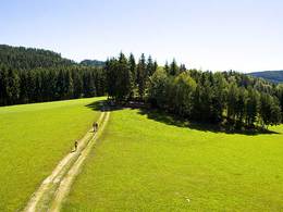
The starting point is the Gasthaus Pfandlwirt (Rosenhammer-Stegmüller family) in Munderfing, parcel no. 7 on hiking trail no. 148 towards Weißenstein, or at the junction with trail no. 149 as a shorter route via trail no. 136 back to the starting point.
Most economical season
- Spring
- Summer
- Autumn
Please get in touch for more information.
Dorfplatz 1
5222 Munderfing
Phone +43 7744 6255
E-Mail gemeinde@munderfing.ooe.gv.at
Web www.munderfing.at
http://www.munderfing.at
Interactive elevation profile
Create PDF
Tour-Details
Starting place: 5222 Munderfing
Destination: 5222 Munderfing
duration: 1h 34m
length: 4,5 km
Altitude difference (uphill): 220m
Altitude difference (downhill): 223m
Lowest point: 492m
Highest point: 693m
difficulty: easy
condition: easy
panoramic view: No view
Paths covering:
Asphalt, Gravel, Hiking trail
powered by TOURDATA