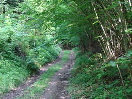
© Photo: Oberösterreich Tourismus GmbH./Robert Maybach: Enjoy the view in Upper Austria


Leithental-Weg 11,5 km


- Suitable for families
Interactive elevation profile
Create PDF
Tour-Details
Starting place: 4722 Peuerbach
Destination: 4722 Peuerbach
duration: 3h 13m
length: 11,5 km
Altitude difference (uphill): 220m
Altitude difference (downhill): 215m
Lowest point: 365m
Highest point: 488m
difficulty: medium
condition: medium
panoramic view: Individual Views
Paths covering:
Asphalt, Gravel, Hiking trail
powered by TOURDATA
Starting point and destination: Peuerbach Castle. From the castle, cross the main road and walk across the church square to the parish church. Turn right in front of the church, walk around the old primary school, cross the bridge and follow Christoph-Zeller-Straße for a short distance to the left, then take the path to the right and pass the Turner monument. Follow the path along the forest, a short way through the forest and you come to the "Lindner Chapel". After the chapel, turn left onto the goods road and continue left via Hötzmannsberg and Laab to Haargassen. Following the road, you can take a detour to the right into the "Koaserin" nature reserve and learn interesting facts about the biodiversity still preserved here in the nature discovery island. Continue along the road, turn right at the crossroads and follow the road to the next crossroads and cross the bridge. You are already in the Leithental valley, also known as the "Valley of the 7 Mills", one of the most beautiful areas of Peuerbach. From here you can either walk along the road directly through the valley or take the Alm-Mühlen-Runde. The Alm-Mühlen-Runde route along the stream is particularly romantic. If you cross the valley along the road, you have the option of turning left just before the chapel next to the road and taking the Schneiderbauerhöhenweg trail through the forest. When you reach the road, turn left and continue to the crossroads. Here you can continue right via Pühret to Teucht or left via Spielmannsberg to Besenberg. However, once you have crossed the entire valley on the road, you come directly to the village of Teucht, follow the road to the left, go straight ahead at the roundabout and finally turn right towards Steingrüneredt and follow the path to Thomasberg, which finally joins the Keßla country road: Turn right and after approx. 200 metres turn left towards Besenberg. Via Tiefen Weg you return to the centre and via the main road back to the castle
- Suitable for groups
- Suitable for schools
- Suitable for teenagers
- Suitable for seniors
- Suitable for single travelers
- Suitable for families
- Suitable for friends
- Spring
- Summer
- Autumn
Not suitable for wheelchairs. The property is not compliant with Austria's ÖNORM legal standard.
Rathausplatz 1
4722 Peuerbach
Phone +43 7276 2255 - 203
E-Mail stadt@peuerbach.ooe.gv.at
Web www.peuerbach.at
https://www.peuerbach.at
Interactive elevation profile
Create PDF
Tour-Details
Starting place: 4722 Peuerbach
Destination: 4722 Peuerbach
duration: 3h 13m
length: 11,5 km
Altitude difference (uphill): 220m
Altitude difference (downhill): 215m
Lowest point: 365m
Highest point: 488m
difficulty: medium
condition: medium
panoramic view: Individual Views
Paths covering:
Asphalt, Gravel, Hiking trail
powered by TOURDATA