© Photo: Oberösterreich Tourismus GmbH./Robert Maybach: Enjoy the view in Upper Austria


Most-Wanderweg, 15 km
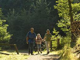


- Suitable for families
Interactive elevation profile
Create PDF
Tour-Details
Starting place: 4722 Peuerbach
Destination: 4722 Peuerbach
duration: 4h 52m
length: 18,1 km
Altitude difference (uphill): 246m
Altitude difference (downhill): 243m
Lowest point: 380m
Highest point: 481m
difficulty: easy
condition: medium
panoramic view: Individual Views
Paths covering:
Asphalt, Gravel, unfixed
powered by TOURDATA
Starting point and destination: Peuerbach Castle. The cider trail provides an insight into the western farming country with its cider orchards around Peuerbach and Steegen. From the castle, follow the main road to the left (towards Passau) and then turn left into Steegenstraße, right into Hopfengasse and follow the path via Enzing to a chapel, where you turn right twice towards Krottenthal. The path then turns left via Griesbach and turns right before the village of Obererleinsbach. Turn right again to reach Rittberg, cross the B 129 and keep right at the chapel on the main road until you follow the path to the left and Langenpeuerbach after a few metres. At the fork there, turn left through Sallet and turn sharp right and right again in Unterbubenberg. (In rainy weather, it is advisable to turn right at the fork: the second path on the left is the "Knoblweg" which leads to the path to Köppensteegen). Cross the Hirnbrücke bridge, turn left and follow the path to Köppensteegen and Steingrüneredt. In Thomasberg, turn right to Ranna, right at the fork, left to Asing, cross the B 129 again and return to Peuerbach Castle via Steinbruck, Hofpengasse and Steegenstraße.
- Suitable for groups
- Suitable for schools
- Suitable for teenagers
- Suitable for seniors
- Suitable for single travelers
- Suitable for families
- Suitable for friends
- Spring
- Summer
- Autumn
Please get in touch for more information.
Rathausplatz 1
4722 Peuerbach
Phone +43 7276 2255 - 203
E-Mail stadt@peuerbach.ooe.gv.at
Web www.peuerbach.at
https://www.peuerbach.at
Interactive elevation profile
Create PDF
Tour-Details
Starting place: 4722 Peuerbach
Destination: 4722 Peuerbach
duration: 4h 52m
length: 18,1 km
Altitude difference (uphill): 246m
Altitude difference (downhill): 243m
Lowest point: 380m
Highest point: 481m
difficulty: easy
condition: medium
panoramic view: Individual Views
Paths covering:
Asphalt, Gravel, unfixed
powered by TOURDATA