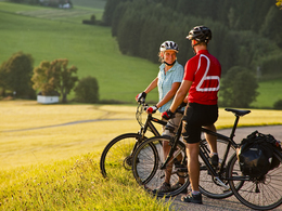
© Photo: Oberösterreich Tourismus GmbH./Robert Maybach: Enjoy the view in Upper Austria


Barock Tour - Rundtour ab Lengau


- Suitable for families
- Flatly
Interactive elevation profile
Create PDF
Tour-Details
Starting place: 5212 Lengau
Destination: 5212 Lengau
duration: 5h 39m
length: 78,2 km
Altitude difference (uphill): 762m
Altitude difference (downhill): 762m
Lowest point: 417m
Highest point: 615m
difficulty: easy
condition: easy
panoramic view: Some Views
Paths covering:
Asphalt, Street, Other
powered by TOURDATA
The tour to the baroque treasures of the Salzburg region starts in Steindorf. From here, the route first descends via Köstendorf into the Eisbachtal valley. This is where the ascent to Schleedorf begins. Once there, turn left in the village and pass the three Egelseen lakes to reach the village of Mattsee. Take the main road to the western shore of the lake. The route continues past Zellhof and Fraham along the Grabensee to Gransdorf and then to Perwang. Now you cycle via Berndorf up to Feichten and then down to Lauterbach in the Oichtental valley. On the other side of the valley, the route heads north and then west via Riedlkam to Lamprechtshausen. Via Dorfbeuern you descend to the Benedictine abbey of Michaelbeuern in the Oichtental valley. After passing the valley, you come up to Rudersberg and shortly afterwards to the well-known village of Perwang. You reach Lochen via the small villages of Sinham, Palting and Astätt. Passing the villages of Lengau and Strasswalchen, you return to the starting point in Steindorf.
- Suitable for groups
- Suitable for seniors
- Suitable for single travelers
- Suitable for families
- Suitable for friends
- Suitable for couples
- Spring
- Summer
- Autumn
Please get in touch for more information.
Stadtplatz 2
5280 Braunau am Inn
Phone +43 7722 62644
E-Mail info@entdeckerviertel.at
Interactive elevation profile
Create PDF
Tour-Details
Starting place: 5212 Lengau
Destination: 5212 Lengau
duration: 5h 39m
length: 78,2 km
Altitude difference (uphill): 762m
Altitude difference (downhill): 762m
Lowest point: 417m
Highest point: 615m
difficulty: easy
condition: easy
panoramic view: Some Views
Paths covering:
Asphalt, Street, Other
powered by TOURDATA