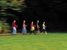
© Photo: Oberösterreich Tourismus GmbH./Robert Maybach: Enjoy the view in Upper Austria


Lauf & Walking Park Friedburg-Lengau RUNDE L4


Interactive elevation profile
Create PDF
Tour-Details
Starting place: 5211 Lengau
Destination: 5211 Lengau
duration: 1h 38m
length: 6,6 km
Altitude difference (uphill): 31m
Altitude difference (downhill): 31m
Lowest point: 504m
Highest point: 529m
difficulty: medium
condition: medium
panoramic view: Individual Views
Paths covering:
Asphalt
powered by TOURDATA
Choose from 8 different Nordic walking and running routes, and there are also connecting routes to the Schneegattern Running & Walking Park with 3 routes, approx. 24 km. The connecting routes V1 & V2 link the route boards from Friedburg - Schneegattern - Naturfreundehaus. These routes are marked but not signposted.
L4 Intersport Eybl loop - mediumMarking: orangeLength: 6.60 kmTotal ascent: 15 hmThe orange Intersport Eybl loop leads through open countryside and smaller villages via Schwöll, then over the Hainbach. Very flat, perfect for relaxing and taking a deep breath. Through Oberehreneck and Unterehreneck, on firm ground, you return to the start at the Volksbank.
L4 Intersport Eybl loop - mediumMarking: orangeLength: 6.60 kmTotal ascent: 15 hmThe orange Intersport Eybl loop leads through open countryside and smaller villages via Schwöll, then over the Hainbach. Very flat, perfect for relaxing and taking a deep breath. Through Oberehreneck and Unterehreneck, on firm ground, you return to the start at the Volksbank.
Most economical season
- Spring
- Summer
- Autumn
- Early winter
- Deep winter
Please get in touch for more information.
Salzburger Strasse 9
5211 Lengau
Phone +43 7746 2202 - 0
E-Mail gemeinde@lengau.ooe.gv.at
Web www.gemeindelengau.at
http://www.gemeindelengau.at
Interactive elevation profile
Create PDF
Tour-Details
Starting place: 5211 Lengau
Destination: 5211 Lengau
duration: 1h 38m
length: 6,6 km
Altitude difference (uphill): 31m
Altitude difference (downhill): 31m
Lowest point: 504m
Highest point: 529m
difficulty: medium
condition: medium
panoramic view: Individual Views
Paths covering:
Asphalt
powered by TOURDATA