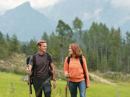
© Photo: Oberösterreich Tourismus GmbH./Robert Maybach: Enjoy the view in Upper Austria


Wanderweg Irger


- All weather
- Suitable for families
- Suitable for kids (all ages)
Interactive elevation profile
Create PDF
Tour-Details
Starting place: 4754 Andrichsfurt
Destination: 4754 Andrichsfurt
duration: 2h 6m
length: 7,6 km
Altitude difference (uphill): 128m
Altitude difference (downhill): 128m
Lowest point: 407m
Highest point: 480m
difficulty: easy
condition: easy
panoramic view: Some Views
Paths covering:
Asphalt, Gravel, Street
powered by TOURDATA
Irger hiking trail (duration approx. 2 hours)
Set off from the centre of Andrichsfurt in the direction of the sports field. Cross the main road and follow the path through the Andrichsfurt wood. After approx. 600 metres you come to the so-called Römerweg, which you cross and continue along the road towards Bruckleiten. In Bruckleiten, turn right towards Kainzing. In Kainzing, turn right towards Jedretsberg, cross the main road and follow the road to Jedretsberg. Turn right at the first junction and follow the road to Irger. Cross the Irgerbach stream and turn right at the next junction. After approx. 1 km, turn right, cross the Irgerbach again and follow the path along the stream. Follow the path to Andrichsfurt and back to the starting point.
Set off from the centre of Andrichsfurt in the direction of the sports field. Cross the main road and follow the path through the Andrichsfurt wood. After approx. 600 metres you come to the so-called Römerweg, which you cross and continue along the road towards Bruckleiten. In Bruckleiten, turn right towards Kainzing. In Kainzing, turn right towards Jedretsberg, cross the main road and follow the road to Jedretsberg. Turn right at the first junction and follow the road to Irger. Cross the Irgerbach stream and turn right at the next junction. After approx. 1 km, turn right, cross the Irgerbach again and follow the path along the stream. Follow the path to Andrichsfurt and back to the starting point.
- All weather
- Suitable for groups
- Suitable for kids (all ages)
- Suitable for seniors
- Suitable for families
- Spring
- Summer
- Autumn
Somewhat suitable for wheelchairs: Assistance is sometimes necessary. The measurements do not (fully) conform to the legally stipulated ÖNORM.
Andrichsfurt 40
4754 Andrichsfurt
Phone +43 7750 3213
E-Mail gemeinde@andrichsfurt.ooe.gv.at
Web www.andrichsfurt.at
http://www.andrichsfurt.at
Interactive elevation profile
Create PDF
Tour-Details
Starting place: 4754 Andrichsfurt
Destination: 4754 Andrichsfurt
duration: 2h 6m
length: 7,6 km
Altitude difference (uphill): 128m
Altitude difference (downhill): 128m
Lowest point: 407m
Highest point: 480m
difficulty: easy
condition: easy
panoramic view: Some Views
Paths covering:
Asphalt, Gravel, Street
powered by TOURDATA