© Photo: Oberösterreich Tourismus GmbH./Robert Maybach: Enjoy the view in Upper Austria


Wanderweg um den Mattsee


- Flatly
Interactive elevation profile
Create PDF
Tour-Details
Starting place: 5221 Lochen
Destination: 5221 Lochen
length: 13,0 km
Lowest point: 538m
Highest point: 538m
difficulty: easy
condition: easy
panoramic view: Some Views
Paths covering:
Asphalt, Gravel, Street, Hiking trail
powered by TOURDATA
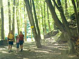
Hiking trail around the Mattsee approx. 13 km.
Most economical season
- Spring
- Summer
- Autumn
Please get in touch for more information.
Ringstrasse 14
5221 Lochen
Phone +43 7745 8255
mobile +43 7722 62644
E-Mail info@entdeckerviertel.at
Web www.lochen.at
Web www.entdeckerviertel.at
http://www.lochen.at
http://www.entdeckerviertel.at
http://www.entdeckerviertel.at
Interactive elevation profile
Create PDF
Tour-Details
Starting place: 5221 Lochen
Destination: 5221 Lochen
length: 13,0 km
Lowest point: 538m
Highest point: 538m
difficulty: easy
condition: easy
panoramic view: Some Views
Paths covering:
Asphalt, Gravel, Street, Hiking trail
powered by TOURDATA