© Photo: Oberösterreich Tourismus GmbH./Robert Maybach: Enjoy the view in Upper Austria


Oberweinberg Nr. 146


Interactive elevation profile
Create PDF
Tour-Details
Starting place: 5222 Munderfing
Destination: 5222 Munderfing
duration: 0h 43m
length: 2,1 km
Altitude difference (uphill): 98m
Altitude difference (downhill): 120m
Lowest point: 495m
Highest point: 617m
difficulty: very easy
condition: very easy
panoramic view: Individual Views
Paths covering:
Hiking trail, Other
powered by TOURDATA
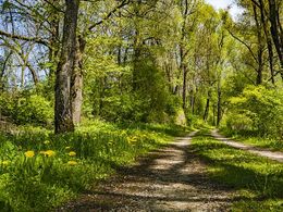
Bradirn - Forsthaus - Oberweinberg to the Bradirn hiking trail (No. 131)
Length: approx. 1.5 km
Length: approx. 1.5 km
Most economical season
- Spring
- Summer
- Autumn
Please get in touch for more information.
Dorfplatz 1
5222 Munderfing
Phone +43 7744 6255
E-Mail gemeinde@munderfing.ooe.gv.at
Web www.munderfing.at
http://www.munderfing.at
Interactive elevation profile
Create PDF
Tour-Details
Starting place: 5222 Munderfing
Destination: 5222 Munderfing
duration: 0h 43m
length: 2,1 km
Altitude difference (uphill): 98m
Altitude difference (downhill): 120m
Lowest point: 495m
Highest point: 617m
difficulty: very easy
condition: very easy
panoramic view: Individual Views
Paths covering:
Hiking trail, Other
powered by TOURDATA