© Photo: Oberösterreich Tourismus GmbH./Robert Maybach: Enjoy the view in Upper Austria


Schauerlix-Runde


- Flatly
Interactive elevation profile
Create PDF
Tour-Details
Path number: 8 - Nordic-Walking
Starting place: 4090 Engelhartszell
Destination: 4090 Engelhartszell
duration: 1h 1m
length: 4,0 km
Altitude difference (uphill): 35m
Altitude difference (downhill): 37m
Lowest point: 697m
Highest point: 734m
difficulty: easy
condition: medium
panoramic view: Individual Views
Paths covering:
Asphalt
powered by TOURDATA
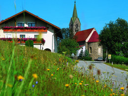
The Schauerlix circuit has trail number 8.
Start at Stadl church - cross the road - straight ahead along the hiking trail - turn right at the forest towards Dorfer - continue along the meadow path then through the forest to the road - continue left - turn left at Schauerlix - along the meadow and forest path back to the road to Stadl- Suitable for groups
- Suitable for single travelers
- Suitable for friends
- Suitable for couples
- Spring
- Summer
- Autumn
Please get in touch for more information.
Marktplatz 61
4090 Engelhartszell
Phone +43 7717 8055 - 16
E-Mail tourismus@engelhartszell.ooe.gv.at
Web www.engelhartszell.at
https://www.engelhartszell.at
Interactive elevation profile
Create PDF
Tour-Details
Path number: 8 - Nordic-Walking
Starting place: 4090 Engelhartszell
Destination: 4090 Engelhartszell
duration: 1h 1m
length: 4,0 km
Altitude difference (uphill): 35m
Altitude difference (downhill): 37m
Lowest point: 697m
Highest point: 734m
difficulty: easy
condition: medium
panoramic view: Individual Views
Paths covering:
Asphalt
powered by TOURDATA