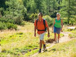
© Photo: Oberösterreich Tourismus GmbH./Robert Maybach: Enjoy the view in Upper Austria


O2 Raphaelshöhenweg


Interactive elevation profile
Create PDF
Tour-Details
Path number: O2
Starting place: 4271 St. Oswald bei Freistadt
Destination: 4271 St. Oswald bei Freistadt
duration: 2h 30m
length: 9,0 km
Altitude difference (uphill): 287m
Altitude difference (downhill): 288m
Lowest point: 619m
Highest point: 894m
difficulty: medium
condition: medium
panoramic view: Some Views
Paths covering:
Hiking trail
powered by TOURDATA
Raphaelshöhenweg
Marking starts at the market tower, along the Nordkammlandesstraße, Am Anger, old Echsenholzstraße, Holzmühle (inn "Zur Holzmühle", Monday rest day), Rosenauweg, Raphaelshöhe, Maria Bründl pilgrimage chapel (inn, Monday rest day), Heinrich Achhorner Weg (Steinbach meditation trail), Ledermühle museum, Bachpromenade, St. Oswald. (approx. 2.5 hours - 9 km) Starting point: Markturm Sankt Oswald near Freistadt
Destination: Sankt Oswald near Freistadt
Accessibility / arrival
by car:
Via the highway from Passau or Salzburg or Vienna via Linz and continue on the A7 (Mühlkreisautobahn) to Unterweitersdorf and then on the Prager Bundesstraße via Freistadt to St. Oswald or Unterweitersdorf via Kefermarkt, Lasberg to St. Oswald b.Fr.
by train:
Via Linz main station and continue on the Linz-Summerau line to the Lasberg/St. Oswald stop or Freistadt station.
Most economical season
- Spring
- Summer
- Autumn
Please get in touch for more information.
Markt 80
4271 St. Oswald bei Freistadt
Phone +43 7945 7255
E-Mail gemeinde@stoswald.at
Web www.stoswald.at
Web www.muehlviertel-urlaub.at/wandern
http://www.stoswald.at
http://www.muehlviertel-urlaub.at/wandern
http://www.muehlviertel-urlaub.at/wandern
Interactive elevation profile
Create PDF
Tour-Details
Path number: O2
Starting place: 4271 St. Oswald bei Freistadt
Destination: 4271 St. Oswald bei Freistadt
duration: 2h 30m
length: 9,0 km
Altitude difference (uphill): 287m
Altitude difference (downhill): 288m
Lowest point: 619m
Highest point: 894m
difficulty: medium
condition: medium
panoramic view: Some Views
Paths covering:
Hiking trail
powered by TOURDATA