© Photo: Oberösterreich Tourismus GmbH./Robert Maybach: Enjoy the view in Upper Austria


Reitererberg S5


- Suitable for families
- Flatly
Interactive elevation profile
Create PDF
Tour-Details
Path number: S5
Starting place: 4364 St. Thomas am Blasenstein
Destination: 4364 St. Thomas am Blasenstein
duration: 3h 33m
length: 11,0 km
Altitude difference (uphill): 413m
Altitude difference (downhill): 413m
Lowest point: 516m
Highest point: 701m
difficulty: difficult
condition: medium
panoramic view: Some Views
Paths covering:
Asphalt, Gravel, unfixed, Hiking trail
powered by TOURDATA
A hike that connects St. Thomas am Bl. and Rechberg.
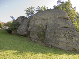
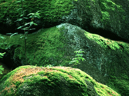
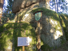
Through the village centre towards the entrance to the village. Before the house at Markt 26, the Wackelstein can be visited on the right (50m beside the path). At the entrance to the village, turn left along the district road towards Pierbach. After the warehouse, the Phallus stone can be visited off the path on the left. Turn left through the forest to the tennis centre. After a steep climb you come to the farmhouse Ober St. Thomas 31 vulgo "Hinterholzer". Turn left before the house, then right again through the forest to the farmhouse vulgo "Kaufrechter". Continue along the road for a short distance and then turn left onto the Reiterer farm track. Continue along the farm track to the top of the Reitererberg, past two farmhouses. You are now in the municipality of Rechberg. After a descent and ascent, turn right into the forest. Past idyllic houses, the Pammerhöhe, along the goods road and then left into the forest. After a descent, again idyllically situated houses and along the Haider estate road almost to the crossroads. Turn right towards Käfermühlbachtal. On the S4 again as an ascent back to the village. Past beautiful rock formations, hedges and meadows. Starting point: In front of the market town hall.
Destination: market town hall.
further information:
- Flatly
all year round but no snow clearance
Accessibility / arrival
By car to the starting point.
Parking- Parking space: 50
- Bus parking space: 1
none
General price information
Hiking map of the Mühlviertel Nature Park (municipalities: Allerheiligen, Bad Zell, St. Thomas, Rechberg) available for € 2.00 at the market town office, GH Ahorner, Puppenhausmuseum and at Nah & Frisch.
- Suitable for groups
- Suitable for schools
- Suitable for kids (10 - 14 Year)
- Suitable for families
- Suitable for friends
- Suitable for couples
- Suitable for children
- Spring
- Summer
- Autumn
Please get in touch for more information.
Markt 7
4364 St. Thomas am Blasenstein
Phone +43 7265 5455
E-Mail marktgemeinde@st-thomas.at
Web www.st-thomas.at
http://www.st-thomas.at
Interactive elevation profile
Create PDF
Tour-Details
Path number: S5
Starting place: 4364 St. Thomas am Blasenstein
Destination: 4364 St. Thomas am Blasenstein
duration: 3h 33m
length: 11,0 km
Altitude difference (uphill): 413m
Altitude difference (downhill): 413m
Lowest point: 516m
Highest point: 701m
difficulty: difficult
condition: medium
panoramic view: Some Views
Paths covering:
Asphalt, Gravel, unfixed, Hiking trail
powered by TOURDATA