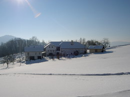
© Photo: Oberösterreich Tourismus GmbH./Robert Maybach: Enjoy the view in Upper Austria


Vier-Höfe-Weg


- pets allowed
- culturally interesting
- Flatly
Interactive elevation profile
Create PDF
Tour-Details
Path number: Hi 5
Starting place: 4242 Hirschbach im Mühlkreis
Destination: 4242 Hirschbach im Mühlkreis
duration: 2h 8m
length: 6,8 km
Altitude difference (uphill): 227m
Altitude difference (downhill): 227m
Lowest point: 613m
Highest point: 738m
difficulty: medium
condition: medium
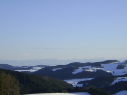
panoramic view: Great panorama
Paths covering:
Hiking trail
powered by TOURDATA
Easy, leisurely hike, also suitable as a walking route!
At the old municipal office, turn left to the Hubertus Chapel, then to Holzwies-Binder via Grünbrunn to Auerbach, then right towards Reitersederhof. Beautiful view of Hirschbach-Ort and the eastern and northern Mühlviertel!Past the Maderhof, Laubertshoferhof and Hollersteinerhof farms, on to Auerbach and via the Schmiedweg in Unterhirschgraben back to Hirschbach-Ort.
Starting point: Hirschbach town square
further information:
- Flatly
Details - hiking
- themed path
Accessibility / arrival
Arrival by car:
From Linz via the A7 (Mühlkreis motorway) towards Prague/Freistadt as far as Unterweitersdorf, then turn left after the end of the motorway (towards Prague/Freistadt) and continue on the B125 to Freistadt. In Freistadt turn left towards Bad Leonfelden (B38). After approx. 1 km, turn left again towards Hirschbach.
Travelling by train:
Take the train from Linz main station, change there to the Linz-Summerau line, get off at Trölsberg (train station near Freistadt).
- Parking space: 20
- Bus parking space: 1
- Suitable for groups
- Suitable for schools
- Pets allowed
- Spring
- Summer
- Autumn
Please get in touch for more information.

Museumsweg 6
4242 Hirschbach im Mühlkreis
Phone +43 7948 55895
E-Mail info@kraeuterkraftquelle.at
Web www.kraeuterkraftquelle.at
http://www.kraeuterkraftquelle.at
http://www.kraeuterkraftquelle.at
http://www.kraeuterkraftquelle.at
Interactive elevation profile
Create PDF
Tour-Details
Path number: Hi 5
Starting place: 4242 Hirschbach im Mühlkreis
Destination: 4242 Hirschbach im Mühlkreis
duration: 2h 8m
length: 6,8 km
Altitude difference (uphill): 227m
Altitude difference (downhill): 227m
Lowest point: 613m
Highest point: 738m
difficulty: medium
condition: medium
panoramic view: Great panorama
Paths covering:
Hiking trail
powered by TOURDATA