© Photo: Oberösterreich Tourismus GmbH./Robert Maybach: Enjoy the view in Upper Austria


Hoader Rundweg Nr. 9


- Flatly
- Possible accommodation
Interactive elevation profile
Create PDF
Tour-Details
Starting place: 4280 Königswiesen
Destination: 4280 Königswiesen
duration: 2h 15m
length: 7,0 km
difficulty: medium
condition: medium
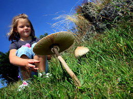
panoramic view: Great panorama
Paths covering:
Hiking trail
powered by TOURDATA
From Haid - Klammleiten - Gfluder (wooden alluvial channel), along the Klammleitenbach - Himmelsleiter - Kanzelstein - Reindlmühle with mill wheel - Diesmühle - Wirer Kreuz - Fragnerpoidl - Stonehill Ranch, marvellous view - Aschenbrenner - Haid
Starting point: Haid
Destination: Haid
further information:
- Flatly
- Possible accommodation
- Board possible
Accessibility / arrival
by car:
A7 Mühlkreis motorway towards Freistadt - turn right onto B124 Königswiesener Straße to Königswiesen
Haid is located a few kilometres north of Köngiswiesen
Most economical season
- Summer
Please get in touch for more information.
4280 Königswiesen
Phone +43 7955 6255
Fax machine +43 7955 6255 - 32
E-Mail marktgemeinde@koenigswiesen.at
Web www.koenigswiesen.at
http://www.koenigswiesen.at
Interactive elevation profile
Create PDF
Tour-Details
Starting place: 4280 Königswiesen
Destination: 4280 Königswiesen
duration: 2h 15m
length: 7,0 km
difficulty: medium
condition: medium
panoramic view: Great panorama
Paths covering:
Hiking trail
powered by TOURDATA