© Photo: Oberösterreich Tourismus GmbH./Robert Maybach: Enjoy the view in Upper Austria


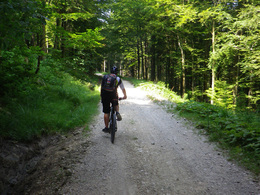
Krahberg MTB


- Flatly
Interactive elevation profile
Create PDF
Tour-Details
Starting place: 4852 Weyregg am Attersee
Destination: 4852 Weyregg am Attersee
duration: 3h 0m
length: 29,1 km
Altitude difference (uphill): 578m
Altitude difference (downhill): 1.172m
Lowest point: 482m
Highest point: 908m
difficulty: medium
condition: medium
panoramic view: Individual Views
Paths covering:
Asphalt
powered by TOURDATA
Start at the Weyregg tourist information centre, turn right towards Seewalchen and before the bridge turn right towards Bach/Gahberg
Sights:
Attersee Aquarium
See-Alpaka
Roman mosaics in the primary school
Attersee shipping (bike transport)
further information:
- Flatly
- Board possible
details mountainbike
- Riding technique: medium
- Suitable for single travelers
- Suitable for friends
- Suitable for couples
- Spring
- Summer
- Autumn
Please get in touch for more information.
Weyreggerstrasse 69
4852 Weyregg am Attersee
Phone +43 7666 7719 - 70
E-Mail info.weyregg@attersee.at
Web attersee-attergau.salzkammergut.at
https://attersee-attergau.salzkammergut.at
You can also visit us on
Visit us on Facebook Visit our videochannel on YouTube WikipediaInteractive elevation profile
Create PDF
Tour-Details
Starting place: 4852 Weyregg am Attersee
Destination: 4852 Weyregg am Attersee
duration: 3h 0m
length: 29,1 km
Altitude difference (uphill): 578m
Altitude difference (downhill): 1.172m
Lowest point: 482m
Highest point: 908m
difficulty: medium
condition: medium
panoramic view: Individual Views
Paths covering:
Asphalt
powered by TOURDATA