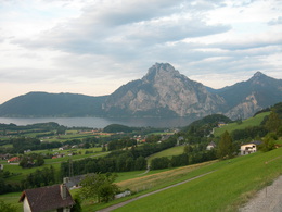
© Photo: Oberösterreich Tourismus GmbH./Robert Maybach: Enjoy the view in Upper Austria


Richtberg MTB


Interactive elevation profile
Create PDF
Tour-Details
Starting place: 4852 Weyregg am Attersee
Destination: 4852 Weyregg am Attersee
duration: 3h 17m
length: 33,9 km
Altitude difference (uphill): 1.115m
Altitude difference (downhill): 1.107m
Lowest point: 474m
Highest point: 854m
difficulty: medium
condition: medium
panoramic view: Great panorama
Paths covering:
Asphalt
powered by TOURDATA
You start at the Weyregg tourist information office and take the road towards Gahberg/Miglberg at the bridge in the centre of the village and continue slightly uphill to the Bach district until you reach the Bach/Gahberg/Miglberg junction
.
Sights:
K.u.K. House museum "In the footsteps of the Habsburgs" in the Imperial and Royal country inn Zur Post
Aquarium at the music pavilion next to the lido
Roman exhibition at the municipal office
Attersee shipping (bike transport)
details mountainbike
- Riding technique: medium
Most economical season
- Summer
Please get in touch for more information.
Weyreggerstraße 69
4852 Weyregg am Attersee
Phone +43 7666 7719 - 70
E-Mail info.weyregg@attersee.at
Web attersee-attergau.salzkammergut.at
https://attersee-attergau.salzkammergut.at
You can also visit us on
Visit us on Facebook Visit our videochannel on YouTube WikipediaInteractive elevation profile
Create PDF
Tour-Details
Starting place: 4852 Weyregg am Attersee
Destination: 4852 Weyregg am Attersee
duration: 3h 17m
length: 33,9 km
Altitude difference (uphill): 1.115m
Altitude difference (downhill): 1.107m
Lowest point: 474m
Highest point: 854m
difficulty: medium
condition: medium
panoramic view: Great panorama
Paths covering:
Asphalt
powered by TOURDATA