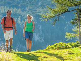
© Photo: Oberösterreich Tourismus GmbH./Robert Maybach: Enjoy the view in Upper Austria


Spregaus - Wurbauerkogel


Interactive elevation profile
Create PDF
Tour-Details
Path number: 5,2
Starting place: 4580 Windischgarsten
Destination: 4580 Windischgarsten
duration: 1h 10m
length: 2,5 km
Altitude difference (uphill): 253m
Altitude difference (downhill): 23m
Lowest point: 598m
Highest point: 837m
difficulty: easy
condition: easy
panoramic view: Some Views
Paths covering:
Asphalt, Hiking trail
powered by TOURDATA
Hike from Windischgarsten to the Spregaus and on to the Wurbauerkogel.
The starting point is the Tourist Information in the main road 28 - between this House and the Cafe Grass Ecker, turn into the Fischergasse, go over the bridge of Dambach and follow the signs. When Alpenvereinshaus keep right - Spregausweg and follow this to the end. Next followed a small gravel pit the nature lovers Steig, on the road no. 2 to the mountain station Wurbauerkogel.Trail-Nr: 3, 2
Accessibility / arrival
by car:
West motorway A1 - exit Voralpenkreuz on the A9 (Pyhrnautobahn) direction Graz - exit Roßleithen / Windischgarsten
by train:
Hauptbahnhof Linz - Windischgarsten
Graz - Selzthal - Windischgarsten
Most economical season
- Spring
- Summer
- Autumn
Please get in touch for more information.

Bahnhofstraße 2
4580 Windischgarsten
Phone +43 7562 5266
E-Mail info@pyhrn-priel.net
Web www.urlaubsregion-pyhrn-priel.at
https://www.urlaubsregion-pyhrn-priel.at
Interactive elevation profile
Create PDF
Tour-Details
Path number: 5,2
Starting place: 4580 Windischgarsten
Destination: 4580 Windischgarsten
duration: 1h 10m
length: 2,5 km
Altitude difference (uphill): 253m
Altitude difference (downhill): 23m
Lowest point: 598m
Highest point: 837m
difficulty: easy
condition: easy
panoramic view: Some Views
Paths covering:
Asphalt, Hiking trail
powered by TOURDATA