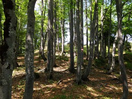
© Photo: Oberösterreich Tourismus GmbH./Robert Maybach: Enjoy the view in Upper Austria


Gspranggupf


Interactive elevation profile
Create PDF
Tour-Details
Starting place: 4820 Bad Ischl
Destination: 4820 Bad Ischl
duration: 5h 6m
length: 8,1 km
Altitude difference (uphill): 906m
Altitude difference (downhill): 898m
Lowest point: 550m
Highest point: 1.314m
difficulty: medium
condition: medium
panoramic view: Great panorama
Paths covering:
Path / trail
powered by TOURDATA
Round walk in the Zimnitz area
Walking time: 2 hours ascent - descent2 hours plus 40 minutes back to Jainzen
Difference in altitude: 820 m ascent, descent 828 m
Requirements: Short distance with fixed ropes secured 5 minutes below the
Summit. Sure footedness is needed on the entire round trip!
From the car park walk down the street, 150 metres straight uphill to a forest road
By the third turn the trail divides at a signpost (47 ° 43'41 "N - 013 ° 37'24 " E -626 m).
Follow the left, narrower road for about 45 minutes to the Saiherbachalm.
Initially there is a magnificent view to the south. From the signpost (47 ° 44'25 "N - 013 ° 36'40 " E - 990 m) at the beginning of the meadow walk directly towards a hut. From this go to
Signpost (47 ° 44'26 "N - 013 ° 36'30 " E -1041 m) at a crossroads by another hut. The trail goes a short distance then turns steeply left. After 100 m, turn right into the forest. After about 30 minutes walking the forest thins slightly. There is a steep grassy area which can be crossed using the tensioned cable. Now it is not far to the summit. Go through a forest to the summit
(47 ° 44'40 "N - 013 ° 36'02 " E - 1368 m) following the signs (don't forget to sign the summit book).
The view to the north is the Höllengebirge (Hell Mountains) and Hohe Schrott to the east.
To the south the high forest blocks the view. On the descent follow the forest back to the northwest towards the Schüttalm (47 ° 45'00 "N - 013 ° 35'22 " E - 1166 m), which is reached after a 30 minute walk. Schüttalm is a small meadow with a sign showing the descent direction. The trail is steep through the forest down to the "Enge Zimnitz". On reaching the forest on the valley floor, there are another 1.5 km to the parking in the Zimnitz. In order to return to Jainzen, there is a walk of about 40 minutes on gravel roads to the starting point.
Most economical season
- Spring
- Summer
- Autumn
Please get in touch for more information.
")
4820 Bad Ischl
Phone +43 6132 27757
Fax machine +43 6132 27757 - 77
E-Mail office@badischl.at
Web www.badischl.at
http://www.badischl.at
Interactive elevation profile
Create PDF
Tour-Details
Starting place: 4820 Bad Ischl
Destination: 4820 Bad Ischl
duration: 5h 6m
length: 8,1 km
Altitude difference (uphill): 906m
Altitude difference (downhill): 898m
Lowest point: 550m
Highest point: 1.314m
difficulty: medium
condition: medium
panoramic view: Great panorama
Paths covering:
Path / trail
powered by TOURDATA