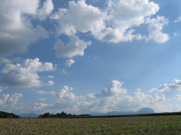
© Photo: Oberösterreich Tourismus GmbH./Robert Maybach: Enjoy the view in Upper Austria


Über d'Moosleitn


- pets allowed
- All weather
- Suitable for pushchairs
- culinary interesting
- culturally interesting
- Flatly
Interactive elevation profile
Create PDF
Tour-Details
Path number: 5
Starting place: 4654 Bad Wimsbach-Neydharting
Destination: 4654 Bad Wimsbach-Neydharting
duration: 1h 35m
length: 6,2 km
Altitude difference (uphill): 52m
Altitude difference (downhill): 49m
Lowest point: 375m
Highest point: 427m
difficulty: easy
condition: medium
panoramic view: Great panorama
Paths covering:
Asphalt, Hiking trail
powered by TOURDATA
The hike leads in the direction of "Privatzimmer-Mostschank Berger" on the right via Moosleitn to the Roithner Chapel. The path continues to the Wimkirche church.
The origins of the church there (Wimkirche) date back to the 13th century. It belonged as a chapel to the Wimsbach vicarage, which was there until 1917. In 1893, the Gothic building was converted into a branch church. The altarpiece depicts the martyrdom of St Thomas of Canterbury. The late Gothic bell is probably from 1479.Straight ahead to the village of Giering - where there is a thousand-year-old lime tree -, right into the valley over the Wimbach and right again through the forest path - past the "Aichmühle", then straight back along the road through the moorland to the Kurhotel Neydharting.
- All weather
- Suitable for groups
- Suitable for schools
- Suitable for pushchairs
- Pets allowed
- Spring
- Summer
- Autumn
Please get in touch for more information.
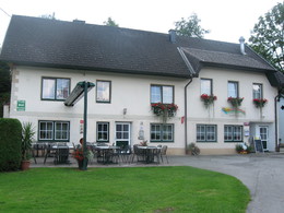
Leitenstraße 13
4654 Bad Wimsbach-Neydharting
Phone +43 7245 25055 - 0
Fax machine +43 7245 25475 - 6
E-Mail gemeinde@bad-wimsbach.ooe.gv.at
Web www.bad-wimsbach.at
Web www.badwimsbach360.at
http://www.bad-wimsbach.at
http://www.badwimsbach360.at
http://www.badwimsbach360.at
Interactive elevation profile
Create PDF
Tour-Details
Path number: 5
Starting place: 4654 Bad Wimsbach-Neydharting
Destination: 4654 Bad Wimsbach-Neydharting
duration: 1h 35m
length: 6,2 km
Altitude difference (uphill): 52m
Altitude difference (downhill): 49m
Lowest point: 375m
Highest point: 427m
difficulty: easy
condition: medium
panoramic view: Great panorama
Paths covering:
Asphalt, Hiking trail
powered by TOURDATA