© Photo: Oberösterreich Tourismus GmbH./Robert Maybach: Enjoy the view in Upper Austria


Von Dorf zu Dorf


- pets allowed
- All weather
- Suitable for pushchairs
- culturally interesting
- Flatly
- Possible accommodation
Interactive elevation profile
Create PDF
Tour-Details
Path number: 14
Starting place: 4654 Bad Wimsbach-Neydharting
Destination: 4654 Bad Wimsbach-Neydharting
duration: 2h 7m
length: 8,5 km
Altitude difference (uphill): 47m
Altitude difference (downhill): 44m
Lowest point: 372m
Highest point: 421m
difficulty: easy
condition: medium
panoramic view: Great panorama
Paths covering:
Asphalt
powered by TOURDATA
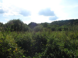
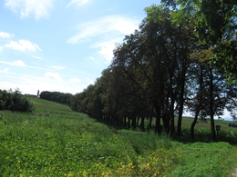
A panoramic circular route that is mainly on the road and therefore ideal for cycling (e-bike hire in the village).
From the market square, the route leads through the Gänsenau towards the Schwarzlmüller "Mairhof" bed and breakfast, to the spa gardens through the moorland to the former "Aichmühle". Continue to the village of Bergham, to the Pötzlberger farmstead, vulgo "Lahmair". Then towards Roithamer Straße, via Fraham, Fürholz to Bachloh (Strasser-Strasser schnapps distillery and Christmas tree sales), past the Stockhammer Chapel, straight on to the Pettenbacher Landesstraße (Eitzlmayr joinery). Via the Ehrenfeld Chapel and the romantic "Kastanienallee" natural monument to the Bad Wimsbach-Neydharting parish church and back to the market square. Parking
- Parking space: 20
- Parking area for disabled: 3
- Bus parking space: 2
- All weather
- Suitable for groups
- Suitable for schools
- Suitable for pushchairs
- Pets allowed
- Spring
- Summer
- Autumn
Please get in touch for more information.
other information
- Toilet facility for disabled people
Neydharting
4654 Bad Wimsbach-Neydharting
Phone +43 7245 25055 - 0
Fax machine +43 7245 25475 - 6
E-Mail gemeinde@bad-wimsbach.ooe.gv.at
Web www.bad-wimsbach.at
Web www.badwimsbach360.at
http://www.bad-wimsbach.at
http://www.badwimsbach360.at
http://www.badwimsbach360.at
You can also visit us on
Visit us on FacebookInteractive elevation profile
Create PDF
Tour-Details
Path number: 14
Starting place: 4654 Bad Wimsbach-Neydharting
Destination: 4654 Bad Wimsbach-Neydharting
duration: 2h 7m
length: 8,5 km
Altitude difference (uphill): 47m
Altitude difference (downhill): 44m
Lowest point: 372m
Highest point: 421m
difficulty: easy
condition: medium
panoramic view: Great panorama
Paths covering:
Asphalt
powered by TOURDATA