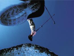
© Photo: Oberösterreich Tourismus GmbH./Robert Maybach: Enjoy the view in Upper Austria


Pinsdorfberg


- Flatly
Interactive elevation profile
Create PDF
Tour-Details
Starting place: 4812 Pinsdorf
Destination: 4812 Pinsdorf
duration: 2h 23m
length: 7,1 km
Altitude difference (uphill): 302m
Altitude difference (downhill): 303m
Lowest point: 485m
Highest point: 684m
difficulty: medium
condition: medium
panoramic view: Individual Views
Paths covering:
Asphalt, Gravel, Street, Hiking trail
powered by TOURDATA
A beautiful trail around the Pinsdorfberg.
Most economical season
- Spring
- Summer
- Autumn
Please get in touch for more information.
Moosweg 3
4812 Pinsdorf
Phone +43 7612 63955
Fax machine +43 7612 63955 - 20
E-Mail tourismusverband@pinsdorf.ooe.gv.at
Web www.pinsdorf.at
http://www.pinsdorf.at
Interactive elevation profile
Create PDF
Tour-Details
Starting place: 4812 Pinsdorf
Destination: 4812 Pinsdorf
duration: 2h 23m
length: 7,1 km
Altitude difference (uphill): 302m
Altitude difference (downhill): 303m
Lowest point: 485m
Highest point: 684m
difficulty: medium
condition: medium
panoramic view: Individual Views
Paths covering:
Asphalt, Gravel, Street, Hiking trail
powered by TOURDATA