© Photo: Oberösterreich Tourismus GmbH./Robert Maybach: Enjoy the view in Upper Austria


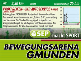
PROFI Reifen Runde by Runnersfun


- pets allowed
- All weather
Interactive elevation profile
Create PDF
Tour-Details
Starting place: 4810 Gmunden
Destination: 4810 Gmunden
duration: 0h 30m
length: 2,1 km
Lowest point: 425m
Highest point: 432m
difficulty: easy
condition: easy
panoramic view: Great panorama
Paths covering:
Asphalt, Gravel
powered by TOURDATA
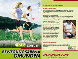
Motion Arena Gmunden
The movement Arena Gmunden flyer card you get very happy guests in the center of the lake Traunsee on Toscanapark 1Toscanapark - Schloss Ort - Congress house - Villa Toscana - Toscanapark
year-round, caution in snow - possibly dangerous ice
Accessibility / arrival
From Salzburg on the motorway A1 to Regau, take the Salzkammergut B145 road towards Gmunden, Altmünster, Ebensee. From Vienna on the motorway A1 to the Laakirchen West exit, take the B144 towards Gmunden and Traunsee Holiday Region (Vorchdorf, Laakrichen East, Regau exit are also options). From Passau on the motorway A8 to Wels motorway interchange, towards Graz/Salzburg until the Voralpenkreuz motorway interchange towards Salzburg on motorway A1 to the Laakirchen West exits, take the B144 to Gmunden and Traunsee Holiday Region (Vorchdorf, Laakirchen East, Regau exits are options).
Parking- Parking space: 300
- Bus parking space: 5
free
General price information
free
- All weather
- Suitable for groups
- Suitable for schools
- Pets allowed
- Spring
- Summer
- Autumn
- Early winter
- Deep winter
Please get in touch for more information.
other information
- Toilet facility for disabled people

Krottenseestraße 45
4810 Gmunden
Phone +43 7612 20822
E-Mail office@runnersfun.com
Web www.runnersfun.com
http://www.runnersfun.com
You can also visit us on
Visit us on FacebookInteractive elevation profile
Create PDF
Tour-Details
Starting place: 4810 Gmunden
Destination: 4810 Gmunden
duration: 0h 30m
length: 2,1 km
Lowest point: 425m
Highest point: 432m
difficulty: easy
condition: easy
panoramic view: Great panorama
Paths covering:
Asphalt, Gravel
powered by TOURDATA