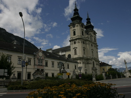
© Photo: Oberösterreich Tourismus GmbH./Robert Maybach: Enjoy the view in Upper Austria


Garstnertaler Round Tour - Green


- Flatly
Interactive elevation profile
Create PDF
Tour-Details
Starting place: 4580 Windischgarsten
Destination: 4580 Windischgarsten
duration: 1h 49m
length: 23,9 km
Altitude difference (uphill): 335m
Altitude difference (downhill): 340m
Lowest point: 591m
Highest point: 806m
difficulty: very easy
condition: very easy
panoramic view: Great panorama
Paths covering:
Asphalt
powered by TOURDATA
Garstnertaler round trip Windischgarsten - Green
E-bike rental with battery changing and charging station: Bikes & Wheels (next to Hotel Dilly).Refreshments with recharging: Kemetmüller pastry shop, Kirchenwirt, Gasthof Seebauer
Starting point: Windischgarsten golf course
Destination: Windischgarsten golf course
further information:
- Flatly
- Board possible
Accessibility / arrival
by car:
Motorway A1 - exit Voralpenkreuz on the A9 (Pyhrnautobahn) direction Graz - exit Roßleithen / Windischgarsten
by train:
Hauptbahnhof Linz - Windischgarsten
Graz - Selzthal - Windischgarsten
- Suitable for groups
- Suitable for seniors
- Suitable for single travelers
- Suitable for friends
- Suitable for couples
- Spring
- Summer
- Autumn
Please get in touch for more information.
")
Bahnhofstraße 2
4580 Windischgarsten
Phone +43 7562 5266
Fax machine +43 7562 5266 - 10
E-Mail info@pyhrn-priel.net
Web www.urlaubsregion-pyhrn-priel.at
https://www.urlaubsregion-pyhrn-priel.at
")

")
")
")
Interactive elevation profile
Create PDF
Tour-Details
Starting place: 4580 Windischgarsten
Destination: 4580 Windischgarsten
duration: 1h 49m
length: 23,9 km
Altitude difference (uphill): 335m
Altitude difference (downhill): 340m
Lowest point: 591m
Highest point: 806m
difficulty: very easy
condition: very easy
panoramic view: Great panorama
Paths covering:
Asphalt
powered by TOURDATA