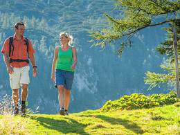
© Photo: Oberösterreich Tourismus GmbH./Robert Maybach: Enjoy the view in Upper Austria
Climbing area Aurachkarplatten


Interactive elevation profile
Create PDF
Tour-Details
Starting place: 4853 Steinbach am Attersee
Destination: 4853 Steinbach am Attersee
duration: 1h 6m
length: 3,3 km
Altitude difference (uphill): 819m
Altitude difference (downhill): 20m
Lowest point: 762m
Highest point: 1.560m
difficulty: medium
condition: medium
panoramic view: Great panorama
Paths covering:
Climbing mount, Hiking trail
powered by TOURDATA
The Aurachkarplatten in the Höllengebirge offer an interesting climbing opportunity on rough rock slabs.
CharacteristicsThe Aurachkarplatten lie vis-à-vis the Grenzeck and offer beautiful climbing on inclined plates, mostly in the rough rocks. Through their exposure to the northwest they will be reached by the sun in the afternoon. At every step, climbers will encounter karst formations resulting from geomorphological processes. The routes are well protected, abseiling is possible with a 50m double rope.
Access: Duration 35 minutes
From the parking area the trail Taferlklaussee No. 826 will follow the direction Hochleckenhaus. Shortly after passing through the St. George's Bründls (wooden trough), the trail makes a sharp turn to the right. Follow the traces of the steep track, then up a giant gravel to reach the foot wall.
Source: Climbing mountains of hell Greifeneder Sabine and Walter Perathoner
- Suitable for teenagers
- Suitable for single travelers
- Suitable for friends
- Suitable for couples
- Spring
- Summer
- Autumn
Please get in touch for more information.
4853 Steinbach am Attersee
Phone +43 7666 7719 - 60
E-Mail info@attersee.at
Web attersee-attergau.salzkammergut.at
https://attersee-attergau.salzkammergut.at
Interactive elevation profile
Create PDF
Tour-Details
Starting place: 4853 Steinbach am Attersee
Destination: 4853 Steinbach am Attersee
duration: 1h 6m
length: 3,3 km
Altitude difference (uphill): 819m
Altitude difference (downhill): 20m
Lowest point: 762m
Highest point: 1.560m
difficulty: medium
condition: medium
panoramic view: Great panorama
Paths covering:
Climbing mount, Hiking trail
powered by TOURDATA
