© Photo: Oberösterreich Tourismus GmbH./Robert Maybach: Enjoy the view in Upper Austria


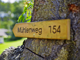
10-Mühlen-Wanderweg Reichenthal


- pets allowed
- All weather
- Suitable for families
- Suitable for kids (all ages)
- culinary interesting
- culturally interesting
- Flatly
- Possible accommodation
Interactive elevation profile
Create PDF
Tour-Details
Starting place: 4193 Reichenthal
Destination: 4193 Reichenthal
duration: 4h 0m
length: 14,1 km
Altitude difference (uphill): 216m
Altitude difference (downhill): 220m
Lowest point: 604m
Highest point: 714m
difficulty: medium
condition: very easy
panoramic view: Great panorama
Paths covering:
Asphalt, Gravel, unfixed, Hiking trail
powered by TOURDATA
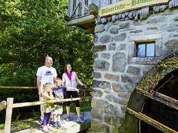
It is the exceptionally beautiful route that characterises the 10-mill hiking trail. The 14-kilometre route often runs directly along the banks of rushing, idyllic streams. The power of the water is also used to operate two of the ten mills you walk past. With a walking time of 4 to 4.5 hours, both sporty and active hikers and nature lovers will get their money's worth.
1st old mill:
Immediately after the sports field, a meadow path leads westwards to the Böhmdorf goods road. After a short walk along the goods road (approx. 200 metres), the hiking trail leads along the edge of a forest to the Altmühle. A viewing bench offers a wonderful view.
2nd Graslmühle:
One of the most beautiful parts of this hiking trail leads after the Altmühle along the Graslbach stream to the Graslmühle. From the Graslmühle, a beautiful path leads to the village of Allhut.
3rd Süßmühle:
The 10-mill hiking trail then leads along the state border with the Czech Republic to Süßmühle.
4th Holzmühle:
From the Süßmühle you hike through a picturesque path to the Holzmühle, also crossing the Kettenbach. To the left of the Kettenbach, you will soon find yourself in the municipality of Rainbach im Mühlkreis (Freistadt district).
5th Lorenzmühle:
After the Holzmühle, the hiking trail leads through a romantic valley to the Lorenzmühle, which is also a cosy refreshment stop.
6th Adammühle:
From the Lorenzmühle, the trail continues again along the Kettenbach stream to the Adammühle.
7th Hammermühle:
The 10-mill hiking trail then leads to a flat forest and meadow path across the Summerauer Bezirksstraße directly to the Hammermühle mill in Niederreichenthal.
8th Hofmühle:
From the Hammermühle, the hiking trail leads along the Kettenbach stream into the village of Hayrl to the Hofmühle.
9th Herrenmühle, 10th Hausmühle:
The trail then continues along the goods road, past the foot of Waldenfels Castle, the castle pond and over the romantic arched bridge of the Kettenbach stream, into the "mill village" to the Hausmühle and Herrenmühle mills.
Finally, the 10-mill hiking trail leads back past the castle pond along the municipal road up to Reichenthal to the starting point.
further information:
- culinary interesting
- Flatly
- Possible accommodation
- Board possible
Details - hiking
- themed path
Parking
- Parking space: 200
- Parking area for disabled: 5
- Bus parking space: 10
- All weather
- Suitable for groups
- Suitable for schools
- Suitable for kids (all ages)
- Pets allowed
- Suitable for teenagers
- Suitable for seniors
- Suitable for single travelers
- Suitable for families
- Suitable for friends
- Suitable for couples
- Suitable for children
- Spring
- Summer
- Autumn
Somewhat suitable for wheelchairs: Assistance is sometimes necessary. The measurements do not (fully) conform to the legally stipulated ÖNORM.
other information
- Toilet facility for disabled people
Hayrl 17
4193 Reichenthal
Phone +43 7214 7007
Fax machine +43 7214 7007 - 18
E-Mail muehlenverein@reichenthal.at
Web www.muehlenverein.at
Web www.reichenthal.at
http://www.muehlenverein.at
http://www.reichenthal.at
http://www.reichenthal.at
")
Interactive elevation profile
Create PDF
Tour-Details
Starting place: 4193 Reichenthal
Destination: 4193 Reichenthal
duration: 4h 0m
length: 14,1 km
Altitude difference (uphill): 216m
Altitude difference (downhill): 220m
Lowest point: 604m
Highest point: 714m
difficulty: medium
condition: very easy
panoramic view: Great panorama
Paths covering:
Asphalt, Gravel, unfixed, Hiking trail
powered by TOURDATA