© Photo: Oberösterreich Tourismus GmbH./Robert Maybach: Enjoy the view in Upper Austria


Herzogsdorf - Neußerling


- Suitable for families
- Flatly
Interactive elevation profile
Create PDF
Tour-Details
Path number: H7
Starting place: 4175 Herzogsdorf
Destination: 4175 Herzogsdorf
duration: 3h 6m
length: 11,7 km
Altitude difference (uphill): 136m
Altitude difference (downhill): 133m
Lowest point: 521m
Highest point: 598m
difficulty: medium
condition: medium
panoramic view: Great panorama
Paths covering:
Asphalt, Gravel, Hiking trail
powered by TOURDATA
information: Akutmeldung/Information
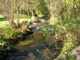
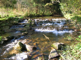
Starting from Herzogsdorf, the hiking trail leads via Eidendorf and Rammerstorf to Neußerling. Via Stötten (Lehmersteig) and Eidendorf you return to Herzogsdorf. The hiking trail has been carefully developed to include old church paths and intact mills (sturdy footwear required). Both Herzogsdorf and Neußerling offer a wide range of catering facilities. The hiking trail can also be started in Neußerling.
- Suitable for groups
- Suitable for schools
- Suitable for single travelers
- Suitable for families
- Suitable for friends
- Suitable for couples
- Suitable for children
- Spring
- Summer
- Autumn
Please get in touch for more information.
Kirchenplatz 10
4175 Herzogsdorf
Phone +43 7231 2255
Fax machine +43 7231 2255 - 40
E-Mail gemeinde@herzogsdorf.ooe.gv.at
Web www.herzogsdorf.at
http://www.herzogsdorf.at
Interactive elevation profile
Create PDF
Tour-Details
Path number: H7
Starting place: 4175 Herzogsdorf
Destination: 4175 Herzogsdorf
duration: 3h 6m
length: 11,7 km
Altitude difference (uphill): 136m
Altitude difference (downhill): 133m
Lowest point: 521m
Highest point: 598m
difficulty: medium
condition: medium
panoramic view: Great panorama
Paths covering:
Asphalt, Gravel, Hiking trail
powered by TOURDATA