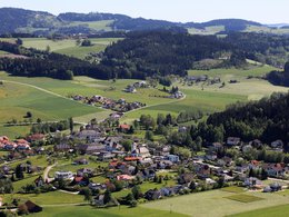
© Photo: Oberösterreich Tourismus GmbH./Robert Maybach: Enjoy the view in Upper Austria


Hofing-Runde


- Suitable for families
- Flatly
Interactive elevation profile
Create PDF
Tour-Details
Path number: H10
Starting place: 4175 Herzogsdorf
Destination: 4175 Herzogsdorf
duration: 2h 11m
length: 7,9 km
Altitude difference (uphill): 133m
Altitude difference (downhill): 135m
Lowest point: 586m
Highest point: 677m
difficulty: easy
condition: easy
panoramic view: Individual Views
Paths covering:
Asphalt, Hiking trail
powered by TOURDATA
From the Neußerling public car park, we walk past the Marienkirche church to the end of the village and continue along the Hofing goods road. We turn right and pass an ancient lime tree on the way to Gronstetter. After a stretch on the road, we turn onto a quiet meadow path that leads past the Plakolm. We return to Neußerling via the Fischerhügel hill.
- Suitable for groups
- Suitable for schools
- Suitable for single travelers
- Suitable for families
- Suitable for friends
- Suitable for couples
- Suitable for children
- Spring
- Summer
- Autumn
Please get in touch for more information.
Kirchenplatz 10
4175 Herzogsdorf
Phone +43 7231 2255
Fax machine +43 7231 2255 - 40
E-Mail gemeinde@herzgsdorf.ooe.gv.at
Web www.herzogsdorf.at
http://www.herzogsdorf.at
Interactive elevation profile
Create PDF
Tour-Details
Path number: H10
Starting place: 4175 Herzogsdorf
Destination: 4175 Herzogsdorf
duration: 2h 11m
length: 7,9 km
Altitude difference (uphill): 133m
Altitude difference (downhill): 135m
Lowest point: 586m
Highest point: 677m
difficulty: easy
condition: easy
panoramic view: Individual Views
Paths covering:
Asphalt, Hiking trail
powered by TOURDATA