© Photo: Oberösterreich Tourismus GmbH./Robert Maybach: Enjoy the view in Upper Austria


H2 DM Drogerie Markt Runde


- Flatly
Interactive elevation profile
Create PDF
Tour-Details
Path number: H2
Starting place: 4540 Bad Hall
Destination: 4540 Bad Hall
duration: 1h 50m
length: 6,5 km
Altitude difference (uphill): 126m
Altitude difference (downhill): 126m
Lowest point: 353m
Highest point: 425m
difficulty: easy
condition: easy
panoramic view: Individual Views
Paths covering:
Asphalt, Gravel
powered by TOURDATA
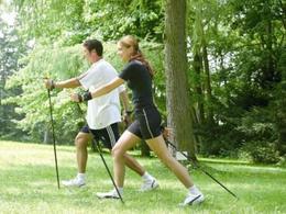
On the blue "Klinikum Bad Hall Runde", you will be travelling through open countryside as well as interesting residential areas. The gently undulating, short loop presents itself with different ground conditions on which you can perfectly switch off and relax. It runs from the Kurpark in the direction of Mühlgrub along Zollnerstraße, continuing along Hallerweg through a quiet woodland area back to the Kurpark.
Most economical season
- Spring
- Summer
- Autumn
Please get in touch for more information.
Kurpromenade 1
4540 Bad Hall
Phone +43 7258 7200 - 0
E-Mail info@badhall.at
Web www.badhall.at
https://www.badhall.at
Interactive elevation profile
Create PDF
Tour-Details
Path number: H2
Starting place: 4540 Bad Hall
Destination: 4540 Bad Hall
duration: 1h 50m
length: 6,5 km
Altitude difference (uphill): 126m
Altitude difference (downhill): 126m
Lowest point: 353m
Highest point: 425m
difficulty: easy
condition: easy
panoramic view: Individual Views
Paths covering:
Asphalt, Gravel
powered by TOURDATA