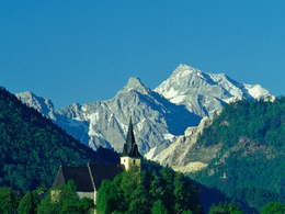
© Photo: Oberösterreich Tourismus GmbH./Robert Maybach: Enjoy the view in Upper Austria


Frauenstein - Paltenbach


- Flatly
Interactive elevation profile
Create PDF
Tour-Details
Starting place: 4564 Klaus an der Pyhrnbahn
Destination: 4564 Klaus an der Pyhrnbahn
duration: 0h 58m
length: 10,9 km
Altitude difference (uphill): 300m
Altitude difference (downhill): 298m
Lowest point: 413m
Highest point: 516m
difficulty: medium
condition: medium
panoramic view: Dreamtour
Paths covering:
Asphalt
powered by TOURDATA
Is started at the Gasthof "Zur Steinwänd." You cycle turning left on the Steyr Taler bike trail to the junction for woman stone. After crossing the bridge, Steyr, the route up to the Sanctuary woman stone.
"To our women Capel on the stone"
The Sanctuary woman stone stands on a 502 m high hill above the Steyr. The church is known for both a popular pilgrim destination, as well as weddings.
First documented in 1300, the church was built on the site of the medieval castle Steyrstain.
Right next to the church, they can disengage briefly in the spring inn Lehner. To return to the valley, they take the Forsthub and after 5 km turn left on the Paltental back to Göritz. The rest of the route as they roll on the outward journey on the Steyr bridge (detour to the Art Nouveau power plant possible) and the Steyr Taler bike path back to the inn "Zur Steinwänd".
Starting point: Hof zur Steinwänd
Destination: Hof zur Steinwänd
further information:
- Flatly
Accessibility / arrival
Klaus - Former GH to Steinwänd
Parking feesno
Most economical season
- Spring
- Summer
- Autumn
- Early winter
Please get in touch for more information.
Stadtplatz 27
4400 Steyr
Phone +43 7252 53229
E-Mail info@steyr-nationalpark.at
Web www.steyr-nationalpark.at/
https://www.steyr-nationalpark.at/
Interactive elevation profile
Create PDF
Tour-Details
Starting place: 4564 Klaus an der Pyhrnbahn
Destination: 4564 Klaus an der Pyhrnbahn
duration: 0h 58m
length: 10,9 km
Altitude difference (uphill): 300m
Altitude difference (downhill): 298m
Lowest point: 413m
Highest point: 516m
difficulty: medium
condition: medium
panoramic view: Dreamtour
Paths covering:
Asphalt
powered by TOURDATA