© Photo: Oberösterreich Tourismus GmbH./Robert Maybach: Enjoy the view in Upper Austria


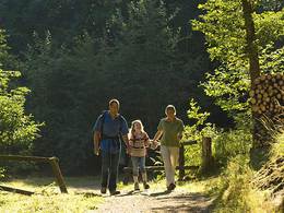
Höhenweg in Pettenbach


Interactive elevation profile
Create PDF
Tour-Details
Path number: K 33
Starting place: 4643 Pettenbach
Destination: 4643 Pettenbach
duration: 4h 29m
length: 12,5 km
Altitude difference (uphill): 623m
Altitude difference (downhill): 732m
Lowest point: 486m
Highest point: 1.043m
difficulty: medium
condition: medium
panoramic view: Some Views
Paths covering:
Asphalt, Gravel, Hiking trail
powered by TOURDATA
Gh. Beer (bus stop Inzersdorf i. Kr. Magdalenabeg) - junction Forststraße - Ederbild - Pernecker Kogel - Kaiserkogel - Kastanienbaum - Mitterkaibling - Friedenskreuz - Heiligenleithen.
From the bus stop Inzersdorf i. Kr. Magdalenaberg, take the goods road to Gasthaus Beer and continue along a forest road to Pernecker Kogel. A short diversions to the Ederbild is recommended.The Pernecker Kogel forms the border between the municipalities of Steinbach am Ziehberg and Pettenbach.
From the Pernecker Kogel, the trail leads along the ridge to the Kaiserkogel. Signposts from the agricultural community mark former farmhouses.
Pass the striking chestnut tree and continue along the forest road to the "Mitterkaibling". From this point, you can hike to the peace cross on the Oberkaibling or to the Heiligenleithen filial church (Ranklleiten bus stop, Sausbachbrücke bridge and Steinbachbrücke railway station).
Most economical season
- Spring
- Summer
- Autumn
Please get in touch for more information.
Im Dorf 17
4645 Grünau im Almtal
Phone +43 7616 8268 - 0
Fax machine +43 7616 8895
E-Mail almtal@traunsee-almtal.at
Web www.traunsee-almtal.at
Web www.pettenbach.at
https://www.traunsee-almtal.at
http://www.pettenbach.at
http://www.pettenbach.at
Interactive elevation profile
Create PDF
Tour-Details
Path number: K 33
Starting place: 4643 Pettenbach
Destination: 4643 Pettenbach
duration: 4h 29m
length: 12,5 km
Altitude difference (uphill): 623m
Altitude difference (downhill): 732m
Lowest point: 486m
Highest point: 1.043m
difficulty: medium
condition: medium
panoramic view: Some Views
Paths covering:
Asphalt, Gravel, Hiking trail
powered by TOURDATA