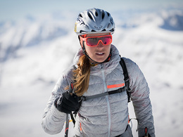
© Photo: Oberösterreich Tourismus GmbH./Robert Maybach: Enjoy the view in Upper Austria


Hagler ski tour (tour area Sengsengebirge)


Interactive elevation profile
Create PDF
Tour-Details
Starting place: 4575 Roßleithen
Destination: 4575 Roßleithen
duration: 3h 43m
length: 3,6 km
Altitude difference (uphill): 992m
Lowest point: 643m
Highest point: 1.634m
difficulty: medium
condition: medium
panoramic view: Great panorama
Paths covering:
snow
powered by TOURDATA
The Hagler in Segsengebirge offers a beautiful view of the Garstnertal and is not as crowded.
From the car park follow the summer trail No. 463, first through the forest and across a clearing until you arrive later at a striking rock wall. Now you cross right over the trail until you reach the Budergraben. (CAUTION: when crossing often prevails herhebliche avalanche danger!)Now in the trench up on beautiful slopes to the saddle between Hagler and Merkenstein to around 1,500 meters. Here you go left across the plateau to the ups and downs, to the north edge is seen, now keeping left over light forest up to the summit of Hagler.
Departure:
Back as ascent track.
Starting point: Hunting lodge Rettenbach
Destination: Hunting lodge Rettenbach
Details - Ski
- Descent: difficulty: medium, 1040 Metres of altitude
Accessibility / arrival
From the motorway exit Windischgarsten you go to rading. Follow the road up to the farmhouse Rettenbach right now and continue following the road up to the cabin Rettenbach.
Most economical season
- Early winter
- Deep winter
Please get in touch for more information.
Bahnhofstraße 2
4575 Roßleithen
Phone +43 7562 5266
Fax machine +43 7562 5266 - 10
E-Mail info@pyhrn-priel.net
Web www.urlaubsregion-pyhrn-priel.at
https://www.urlaubsregion-pyhrn-priel.at
Interactive elevation profile
Create PDF
Tour-Details
Starting place: 4575 Roßleithen
Destination: 4575 Roßleithen
duration: 3h 43m
length: 3,6 km
Altitude difference (uphill): 992m
Lowest point: 643m
Highest point: 1.634m
difficulty: medium
condition: medium
panoramic view: Great panorama
Paths covering:
snow
powered by TOURDATA