© Photo: Oberösterreich Tourismus GmbH./Robert Maybach: Enjoy the view in Upper Austria


Gesunde Gemeinde Ried Runde
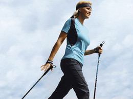


- All weather
- Suitable for families
- Flatly
Interactive elevation profile
Create PDF
Tour-Details
Starting place: 4910 Ried im Innkreis
Destination: 4910 Ried im Innkreis
duration: 1h 0m
length: 8,8 km
Altitude difference (uphill): 109m
Altitude difference (downhill): 109m
Lowest point: 443m
Highest point: 496m
difficulty: medium
condition: medium
panoramic view: Some Views
Paths covering:
Asphalt, Gravel
powered by TOURDATA
From the swimming pool along the Breitsach on meadow and nature trails coppiced round.
")


- All weather
- Suitable for groups
- Suitable for schools
- Suitable for teenagers
- Suitable for single travelers
- Suitable for families
- Suitable for friends
- Suitable for couples
- Suitable for children
- Spring
- Summer
- Autumn
- Early winter
Please get in touch for more information.
4910 Ried im Innkreis
Phone +43 7752 901
E-Mail office@ried.gv.at
Web www.innviertel-tourismus.at/sinnvie…
Web www.ried.at
https://www.innviertel-tourismus.at/sinnviertel-erleben/sport-freizeit/wandern/wanderwege.html
http://www.ried.at
http://www.ried.at
You can also visit us on
Visit us on FacebookInteractive elevation profile
Create PDF
Tour-Details
Starting place: 4910 Ried im Innkreis
Destination: 4910 Ried im Innkreis
duration: 1h 0m
length: 8,8 km
Altitude difference (uphill): 109m
Altitude difference (downhill): 109m
Lowest point: 443m
Highest point: 496m
difficulty: medium
condition: medium
panoramic view: Some Views
Paths covering:
Asphalt, Gravel
powered by TOURDATA