© Photo: Oberösterreich Tourismus GmbH./Robert Maybach: Enjoy the view in Upper Austria


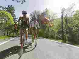
Sportliche Radtour von Ried zum "Römerradweg"


- All weather
- Suitable for families
- Flatly
Interactive elevation profile
Create PDF
Tour-Details
Starting place: 4910 Ried im Innkreis
Destination: 4910 Ried im Innkreis
duration: 2h 49m
length: 40,0 km
Altitude difference (uphill): 326m
Altitude difference (downhill): 367m
Lowest point: 413m
Highest point: 590m
difficulty: medium
condition: medium
panoramic view: Great panorama
Paths covering:
Asphalt
powered by TOURDATA
A wonderful excursion into the gentle and fertile hills of the Innviertel. The varied landscape profile will also offer you a sporty and at the same time enjoyable challenge.
Route:
Ried im Innkreis - Neuhofen im Innkreis - Hauping - Magetsham (via connecting trail 104) - shortly after Magetsham you will meet the Roman cycle path (R6) - Kirchheim im Innkreis - Wildenauer Badesee - Aspach - Mettmach - Lohnsburg am Kobernaußerwald - Waldzell - Magetsham - from Magetsham you return to Ried im Innkreis via connecting trail 104
- All weather
- Suitable for groups
- Suitable for teenagers
- Suitable for seniors
- Suitable for single travelers
- Suitable for friends
- Suitable for couples
- Suitable for children
- Spring
- Summer
- Autumn
Please get in touch for more information.
4910 Ried im Innkreis
Phone +43 7752 901
E-Mail office@ried.gv.at
Web www.ried.at
http://www.ried.at
You can also visit us on
Visit us on FacebookInteractive elevation profile
Create PDF
Tour-Details
Starting place: 4910 Ried im Innkreis
Destination: 4910 Ried im Innkreis
duration: 2h 49m
length: 40,0 km
Altitude difference (uphill): 326m
Altitude difference (downhill): 367m
Lowest point: 413m
Highest point: 590m
difficulty: medium
condition: medium
panoramic view: Great panorama
Paths covering:
Asphalt
powered by TOURDATA