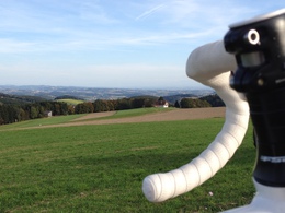
© Photo: Oberösterreich Tourismus GmbH./Robert Maybach: Enjoy the view in Upper Austria


Radtour 1: Rennrad, Trekking- und E-Bike mittel


- culinary interesting
Interactive elevation profile
Create PDF
Tour-Details
Starting place: 4210 Gallneukirchen
Destination: 4210 Gallneukirchen
duration: 2h 0m
length: 30,0 km
Altitude difference (uphill): 426m
Altitude difference (downhill): 426m
Lowest point: 316m
Highest point: 592m
difficulty: medium
condition: medium
panoramic view: Great panorama
Paths covering:
Asphalt
powered by TOURDATA
information: Radtour 1 ist digital aufbereitet
Medium-difficulty tour for road bikes, trekking bikes and e-bikes, put together and tested by former mountain bike pro Roman Rametsteiner.
Starting point: Marketplace
Destination: Marketplace
further information:
- culinary interesting
Accessibility / arrival
How to get here by car:
- From Linz, take the A7 motorway to the "Gallneukirchen" exit
- Follow the road through Gallneukirchen
- After the one-way street, turn diagonally left towards "Alberndorf"
- Follow the road for approx. 7 km
Adequate free parking is available just a few metres away behind the municipal office. Turn left after the Spar supermarket onto Kalchgruberstraße, then turn right.
Travelling by bus:
- From Linz via Gallneukirchen (you may need to change buses) to "Alberndorf/Rdm. Ortsmitte"
- The bus stop is only a few metres away from the Spar supermarket.
Most economical season
- Spring
- Summer
- Autumn
Please get in touch for more information.

Reichenauer Straße 1
4210 Gallneukirchen
Phone +43 7235 63155
E-Mail stadtgemeinde@gallneukirchen.ooe.gv.at
Web www.gallneukirchen.at
Web www.muehlviertel-urlaub.at/rad
https://www.gallneukirchen.at
http://www.muehlviertel-urlaub.at/rad
http://www.muehlviertel-urlaub.at/rad
Interactive elevation profile
Create PDF
Tour-Details
Starting place: 4210 Gallneukirchen
Destination: 4210 Gallneukirchen
duration: 2h 0m
length: 30,0 km
Altitude difference (uphill): 426m
Altitude difference (downhill): 426m
Lowest point: 316m
Highest point: 592m
difficulty: medium
condition: medium
panoramic view: Great panorama
Paths covering:
Asphalt
powered by TOURDATA