© Photo: Oberösterreich Tourismus GmbH./Robert Maybach: Enjoy the view in Upper Austria


Themenweg G3A: Kleiner Rundgang - Gallinger Höhenweg Biotop


Interactive elevation profile
Create PDF
Tour-Details
Starting place: 4210 Gallneukirchen
Destination: 4210 Gallneukirchen
duration: 0h 13m
length: 0,8 km
Altitude difference (uphill): 10m
Altitude difference (downhill): 10m
Lowest point: 391m
Highest point: 403m
difficulty: easy
condition: easy
panoramic view: Individual Views
Paths covering:
Asphalt, Hiking trail
powered by TOURDATA
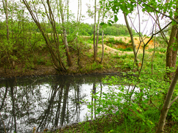
This themed trail can be combined with the Gallinger Höhenweg. A beautiful, quiet and short circular trail that leads partly on the terrace of the horse-drawn railway through the forest and next to grassland. Ideal for people looking for peace and quiet.
Accessibility / arrival
How to get here by car:
- From Linz, take the A7 motorway to the "Gallneukirchen" exit
- Follow the road through Gallneukirchen
- After the one-way street, turn diagonally left towards "Alberndorf"
- Follow the road for approx. 7 km
Adequate free parking is available just a few metres away behind the municipal office. Turn left after the Spar supermarket onto Kalchgruberstraße, then turn right.
Travelling by bus:
- From Linz via Gallneukirchen (you may need to change buses) to "Alberndorf/Rdm. Ortsmitte"
- The bus stop is only a few metres away from the Spar supermarket.
Most economical season
- Spring
- Summer
- Autumn
Please get in touch for more information.
Reichenauer Straße 1
4210 Gallneukirchen
Phone +43 7235 63155
E-Mail stadtgemeinde@gallneukirchen.ooe.gv.at
Web www.gallneukirchen.at/STADT_er_lebe…
Web www.muehlviertel-urlaub.at/wandern
https://www.gallneukirchen.at/STADT_er_leben/Tourismus_Freizeit/Wanderwege
http://www.muehlviertel-urlaub.at/wandern
http://www.muehlviertel-urlaub.at/wandern
Interactive elevation profile
Create PDF
Tour-Details
Starting place: 4210 Gallneukirchen
Destination: 4210 Gallneukirchen
duration: 0h 13m
length: 0,8 km
Altitude difference (uphill): 10m
Altitude difference (downhill): 10m
Lowest point: 391m
Highest point: 403m
difficulty: easy
condition: easy
panoramic view: Individual Views
Paths covering:
Asphalt, Hiking trail
powered by TOURDATA