© Photo: Oberösterreich Tourismus GmbH./Robert Maybach: Enjoy the view in Upper Austria


Die Hongar Tour


- All weather
- Suitable for families
Interactive elevation profile
Create PDF
Tour-Details
Path number: 1
Starting place: 4814 Aurach am Hongar
Destination: 4814 Aurach am Hongar
duration: 4h 30m
length: 13,4 km
Altitude difference (uphill): 458m
Altitude difference (downhill): 455m
Lowest point: 595m
Highest point: 970m
difficulty: easy
condition: medium
panoramic view: Great panorama
Paths covering:
Gravel, Hiking trail
powered by TOURDATA
Hike through meadows and forests to the heights of the foothills of the Alps
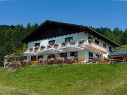
After about an hour's further walk in the direction of the "Kreuzing Alm", across the entire forest and meadow ridge, there are only 90 metres of altitude to conquer. The "Kreuzing Alm" excursion inn on the Miglberg offers home-style cooking and from the guest garden you can enjoy the fantastic view of the Höllengebirge massif.
For the way back, take the forest road along the Wessenaurach, which will take you back to the starting point of the hike in around 1.5 hours.
Alpenberg, Weyregg am Attersee, Vöcklabruck, Oberösterreich, 4852, Österreich
Hongar, Aurach am Hongar, Vöcklabruck, Oberösterreich, 4861, Österreich
Kasten, Vöcklabruck, Oberösterreich, Österreich
Kreuzing Alm, Forststraße Scheidgraben, Weyregg am Attersee, Vöcklabruck, Oberösterreich, 4852, Österreich
Wessenaurach, Aurach am Hongar, Vöcklabruck, Oberösterreich, 4861, Österreich
Wessenaurach, Aurach am Hongar, Vöcklabruck, Oberösterreich, 4861, Österreich
Parking
- Parking space: 30
- Parking area for disabled: 5
- All weather
- Suitable for families
- Spring
- Summer
- Autumn
Please get in touch for more information.

Kasten 32
4861 Weyregg am Attersee
Phone +43 7612 64305
E-Mail gasthaus.schwarz@hongar.at
Web www.traunsee.at/wandern
http://www.traunsee.at/wandern
Interactive elevation profile
Create PDF
Tour-Details
Path number: 1
Starting place: 4814 Aurach am Hongar
Destination: 4814 Aurach am Hongar
duration: 4h 30m
length: 13,4 km
Altitude difference (uphill): 458m
Altitude difference (downhill): 455m
Lowest point: 595m
Highest point: 970m
difficulty: easy
condition: medium
panoramic view: Great panorama
Paths covering:
Gravel, Hiking trail
powered by TOURDATA