© Photo: Oberösterreich Tourismus GmbH./Robert Maybach: Enjoy the view in Upper Austria
Enjoy the view in Upper Austria
search
Search
Close

Bad Hall Rennrad Tour Drei Täler Schaukel

 Interactive elevation profile

Download GPS data
Create PDF

Tour-Details

Starting place: 4540 Bad Hall
Destination: 4540 Bad Hall

duration: 3h 9m
length: 80,0 km
Altitude difference (uphill): 1.420m
Altitude difference (downhill): 1.414m

difficulty: difficult
condition: difficult
panoramic view: Great panorama

Paths covering:
Asphalt

powered by TOURDATA

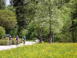
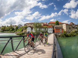
A crisp tour over the hills between the Enns, Steyr and Kremstal valleys.

Three notable climbs, a small final challenge and a few metres of altitude in between combine to form a two-thousander on this parade route for climbing enthusiasts. There is time to warm up for a good ten kilometres at the beginning, then you climb the Hochhub (809 m) - a magnificent mountain range that separates the Steyr and Enns valleys - via the Haagen goods road at varying gradients. Passing two inns, you hurtle down to the national cycle path R7, which leads flat along the deep green Enns to Ternberg. Just before the town centre, the "Schweinsegg" goods road branches off and the next 300 metres of ascent await. After the descent into the Steyrtal valley and a few flat, romantic kilometres through the Steinbach settlement area, the river is crossed at the Haunoldmühle mill: "the Windhager" - sunny and tough with a few steep stretches - awaits. In Oberschlierbach, the panorama once again rewards you for all your efforts, and the descent to Hofern takes care of the rest. The route through the Kremsau and to Wartberg offers relaxation before a final bump lurks behind Kremsmünster.


Travelling by public transport
Route planner for independent travellers
  • Suitable for single travelers
  • Suitable for friends
  • Suitable for couples
Most economical season
  • Spring
  • Summer
  • Autumn

Please get in touch for more information.


Bad Hall Rennrad Tour Drei Täler Schaukel
Tourismusverband Bad Hall
Kurpromenade 1
4540 Bad Hall

Phone +43 7258 7200 - 0
E-Mail info@badhall.at
Web www.badhall.at
https://www.badhall.at

We speak the following languages

German

 Interactive elevation profile

Download GPS data
Create PDF

Tour-Details

Starting place: 4540 Bad Hall
Destination: 4540 Bad Hall

duration: 3h 9m
length: 80,0 km
Altitude difference (uphill): 1.420m
Altitude difference (downhill): 1.414m

difficulty: difficult
condition: difficult
panoramic view: Great panorama

Paths covering:
Asphalt

powered by TOURDATA