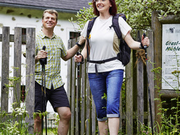
© Photo: Oberösterreich Tourismus GmbH./Robert Maybach: Enjoy the view in Upper Austria


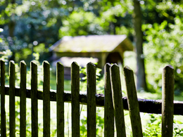
Waldenfels Wanderweg


- pets allowed
- All weather
- Suitable for families
- Suitable for pushchairs
- Suitable for kids (all ages)
- Flatly
Interactive elevation profile
Create PDF
Tour-Details
Starting place: 4193 Reichenthal
Destination: 4193 Reichenthal
duration: 0h 43m
length: 2,6 km
Altitude difference (uphill): 44m
Altitude difference (downhill): 47m
Lowest point: 657m
Highest point: 688m
difficulty: very easy
condition: easy
panoramic view: Individual Views
Paths covering:
Asphalt, Hiking trail
powered by TOURDATA
Starting from the market square, the Waldenfels hiking trail takes you on a four-kilometre hike through the beautiful surroundings of Waldenfels Castle. It takes you to the favourite places of the Counts Grundemann von Falkenberg, who have resided at Waldenfels Castle for centuries: Past the castle pond, along the Kettenbach stream and ...
Parking
- Parking space: 200
- Parking area for disabled: 5
- Bus parking space: 10
- All weather
- Suitable for kids (all ages)
- Suitable for pushchairs
- Pets allowed
- Suitable for seniors
- Suitable for single travelers
- Suitable for families
- Spring
- Summer
- Autumn
Please get in touch for more information.
Marktplatz
4193 Reichenthal
Phone +43 7214 7007
Fax machine +43 7214 7007 - 18
E-Mail gemeinde@reichenthal.at
Web www.reichenthal.at
http://www.reichenthal.at
Interactive elevation profile
Create PDF
Tour-Details
Starting place: 4193 Reichenthal
Destination: 4193 Reichenthal
duration: 0h 43m
length: 2,6 km
Altitude difference (uphill): 44m
Altitude difference (downhill): 47m
Lowest point: 657m
Highest point: 688m
difficulty: very easy
condition: easy
panoramic view: Individual Views
Paths covering:
Asphalt, Hiking trail
powered by TOURDATA