

Josefweg - 2nd stage of the spiritual round course


Interactive elevation profile
Create PDF
Tour-Details
Paths covering:
The Josefweg is a spiritual circular route from Lake Traunsee to Lake Attersee and back in 3 daily stages. The 2nd stage leads from Weyregg am Attersee to the Großalm.
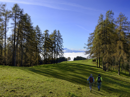
Stage 2:Today's stage is the shortest at 17 km.
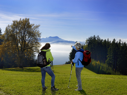
The Jubiläumsallee takes you to the show aquarium and you can also make a detour to the parish church in Weyregg. The hiking trail then continues along the Attersee-Ostuferweg, which initially includes the Wasser-Roas-Weg (interesting information boards about Lake Attersee).
After a good hour's walk, the Gasthof Bramosen is a good place to stop for a bite to eat (last option until today's destination).
From Alexenau, the route climbs steeply towards Bramosen, partly on paths, partly on forest roads.
At the Seeleitenstüberl you can fill up with fresh spring water, after about 500 metres you head east and stay on forest roads for the rest of the day - there are crossroads along the way with the evocative names of Praterstern and Almstall.
The forest roads lead slightly uphill, mostly downhill - you can therefore use the route well for intensive conversations or an inner retreat.
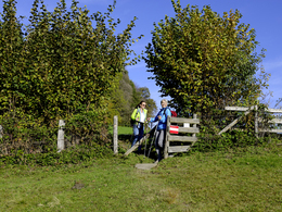
As soon as the forest road joins the main road, keep right and walk approx. 800 m westwards. Don't miss a visit to the Nadasdy chapel.
The 'Gasthof Großalm' sign points to today's destination.
You can make good use of the longer "end of the day" to get to know the Großalm better, as the house has a very interesting history with a beautiful house chapel.
Total walking time 4 - 5 h, 17 km
The Traunsee-Taxi will take you to your destination (route Großalm - Altmünster) from Monday to Sunday from 7.00 am to 8.00 pm at favourable prices by calling 050 422 422! Please call 1 hour before departure! Further information is available from the tourist offices in the Traunsee holiday region and at www.traunseetaxi.at


We recommend travelling by public transport:
By train:
Travel on the Westbahn line to Attnang-Puchheim or Vöcklabruck station, change to the regional train to Kammer/Schörfling.
From there, take the OÖVV bus line 562 to Weyregg am Attersee.
Journey to Steinbach am Attersee:
By train:
On the Salzkammergut railway to Altmünster station.
Per Salzkammergut Shutte Service line 20 to Steinbach am Attersee. Call +43 50 422 422 and order at least one hour before departure.
From Steinbach am Attersee it is approx. 8 kilometres to Weyregg am Attersee
Travel to Steinbach am Attersee.
- Suitable for groups
- Suitable for teenagers
- Suitable for single travelers
- Suitable for friends
- Spring
- Summer
- Autumn
Please get in touch for more information.
Weyregger Straße 69
4852 Weyregg am Attersee
Phone +43 7666 7719 - 70
Fax machine +43 7666 7719 - 70
E-Mail info.weyregg@attersee.at
Web www.josefweg-salzkammergut.at
Interactive elevation profile
Create PDF
Tour-Details
Paths covering: