© Photo: Oberösterreich Tourismus GmbH./Robert Maybach: Enjoy the view in Upper Austria


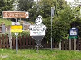
Mostdipfwanderweg Hellmonsödt - Pelmberg 3 km


- Suitable for families
- culinary interesting
Interactive elevation profile
Create PDF
Tour-Details
Path number: 18, 160
Starting place: 4202 Hellmonsödt
Destination: 4202 Hellmonsödt
duration: 0h 48m
length: 2,9 km
Altitude difference (uphill): 44m
Altitude difference (downhill): 65m
Lowest point: 801m
Highest point: 835m
difficulty: easy
condition: easy
panoramic view: Some Views
Paths covering:
Gravel, Hiking trail
powered by TOURDATA
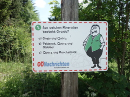
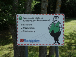
The Mostdipfwanderweg starts in Hellmonsödt in the district of Althellmonsödt and leads us on trail number 160 through the Breitlusserwald forest to the village of Pelmberg. There are 16 quiz stations with questions and answers about the Mühlviertel over a length of approx. 3 km. The trail is well signposted and accessible all year round.
further information:
- culinary interesting
- Board possible
Details - hiking
- themed path
Parking
- Parking space: 100
- Bus parking space: 3
- Free entry
- Suitable for groups
- Suitable for schools
- Suitable for teenagers
- Suitable for seniors
- Suitable for single travelers
- Suitable for families
- Suitable for friends
- Suitable for couples
- Suitable for children
- Spring
- Summer
- Autumn
- Early winter
- Deep winter
Please get in touch for more information.

Pelmberg 2
4202 Hellmonsödt
Phone +43 7215 39110
mobile +43 664 4146237
E-Mail pelmbergstueberl@aon.at
Web www.pelmbergstueberl.at
http://www.pelmbergstueberl.at
Interactive elevation profile
Create PDF
Tour-Details
Path number: 18, 160
Starting place: 4202 Hellmonsödt
Destination: 4202 Hellmonsödt
duration: 0h 48m
length: 2,9 km
Altitude difference (uphill): 44m
Altitude difference (downhill): 65m
Lowest point: 801m
Highest point: 835m
difficulty: easy
condition: easy
panoramic view: Some Views
Paths covering:
Gravel, Hiking trail
powered by TOURDATA