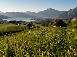
© Photo: Oberösterreich Tourismus GmbH./Robert Maybach: Enjoy the view in Upper Austria


Orte des Glaubens: Juwel Holzkirche am Kolomansberg


- Suitable for families
Interactive elevation profile
Create PDF
Tour-Details
Path number: 17
Starting place: 5310 Tiefgraben am Mondsee
Destination: 5310 Tiefgraben am Mondsee
duration: 3h 8m
length: 8,4 km
Altitude difference (uphill): 467m
Altitude difference (downhill): 466m
Lowest point: 614m
Highest point: 1.082m
difficulty: medium
condition: medium
panoramic view: Individual Views
Paths covering:
Asphalt, Hiking trail
powered by TOURDATA
roadblock: Akutmeldung/Sperre
Description: Attention Kolomannsberg:
The Kolomanskriche can be easily reached via the hiking trails from the Panoramahotel Leidingerhof and the Gasthof Fohlenhof/Camp Mondseeland, as well as from the Thalgau side.
All other hiking trails are not possible! I.e. all hiking trails that start from Gasthof Hochserner, that run over the Kolomanstaferl and that come from Sommerholz.
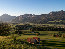
Off to the oldest wooden church in Austria.
This path up the Kolomansberg is signposted throughout as hiking trail no. 8.Details - hiking
- themed path
")
")
")
")
")
")
Parking
- Parking space: 10
- Bus parking space: 1
- Suitable for groups
- Suitable for schools
- Suitable for teenagers
- Suitable for seniors
- Suitable for single travelers
- Suitable for families
- Suitable for friends
- Suitable for couples
- Spring
- Summer
- Autumn
Please get in touch for more information.
Kirchengasse 1
5310 Mondsee am Mondsee
Phone +43 6232 4166
E-Mail pfarre.mondsee@dioezese-linz.at
Web www.dioezese-linz.at/mondsee
https://www.dioezese-linz.at/mondsee
Interactive elevation profile
Create PDF
Tour-Details
Path number: 17
Starting place: 5310 Tiefgraben am Mondsee
Destination: 5310 Tiefgraben am Mondsee
duration: 3h 8m
length: 8,4 km
Altitude difference (uphill): 467m
Altitude difference (downhill): 466m
Lowest point: 614m
Highest point: 1.082m
difficulty: medium
condition: medium
panoramic view: Individual Views
Paths covering:
Asphalt, Hiking trail
powered by TOURDATA