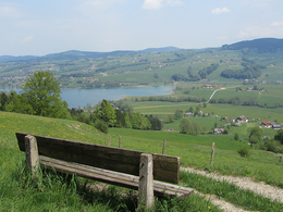
© Photo: Oberösterreich Tourismus GmbH./Robert Maybach: Enjoy the view in Upper Austria


Orte des Glaubens: Sagenhaftes am Kolomansberg


- Flatly
Interactive elevation profile
Create PDF
Tour-Details
Path number: 18
Starting place: 5310 Tiefgraben am Mondsee
Destination: 5310 Tiefgraben am Mondsee
duration: 4h 27m
length: 13,6 km
Altitude difference (uphill): 535m
Altitude difference (downhill): 535m
Lowest point: 721m
Highest point: 987m
difficulty: medium
condition: medium
panoramic view: Individual Views
Paths covering:
Asphalt, Hiking trail
powered by TOURDATA
roadblock: Akutmeldung/Sperre
Description: Attention Kolomannsberg:
The Kolomanskriche can be easily reached via the hiking trails from the Panoramahotel Leidingerhof and the Gasthof Fohlenhof/Camp Mondseeland, as well as from the Thalgau side.
All other hiking trails are not possible! I.e. all hiking trails that start from Gasthof Hochserner, that run over the Kolomanstaferl and that come from Sommerholz.
A circular hike on the Kolomansberg.
From the car park, follow the markings to the Kolomanstaferl. The Leitner-Marterl (item 203) is about 300 metres off the forest road, which we cross. From Kolomanstaferl (pos. 204), follow the Arnoweg in a northerly direction to the Toten Mann (pos. 205) and the Goldene Kutsche (pos. 206). The hiking trail continues to Sommerholz, where it is worth visiting the church (item 355). A magnificent view awaits us on the hill. We return via Stock on the forest road (towards Schernthan) and follow the signposts to Gasthof Hochserner.further information:
- Flatly
Details - hiking
- themed path

")
")
")
")
")
")
Parking
- Parking space: 20
- Suitable for seniors
- Suitable for single travelers
- Suitable for friends
- Suitable for couples
- Spring
- Summer
- Autumn
- Early winter
Please get in touch for more information.
Kirchengasse 1
5310 Mondsee am Mondsee
Phone +43 6232 4166
E-Mail pfarre.mondsee@dioezese-linz.at
Web www.dioezese-linz.at/mondsee
https://www.dioezese-linz.at/mondsee
Interactive elevation profile
Create PDF
Tour-Details
Path number: 18
Starting place: 5310 Tiefgraben am Mondsee
Destination: 5310 Tiefgraben am Mondsee
duration: 4h 27m
length: 13,6 km
Altitude difference (uphill): 535m
Altitude difference (downhill): 535m
Lowest point: 721m
Highest point: 987m
difficulty: medium
condition: medium
panoramic view: Individual Views
Paths covering:
Asphalt, Hiking trail
powered by TOURDATA